Sichuan Province in China has dense forests and often causes large wildfires due to dry weather. According to statistics, in 2019 and 2020, many large forest fires occurred in Sichuan, and 50 firefigh
Rapid 3mins Emergency Deployment
Automated gates and rapid charging ensure drone readiness in under 3 minutes, significantly faster than manual setup.
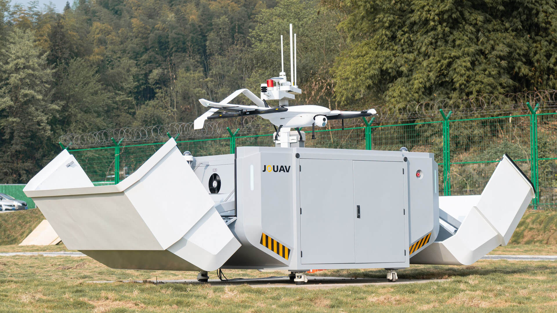

End-to-End Automation
Automated missions with pre-programmed launch, landing, and data transfer enable swift responses, even in remote locations or outside of normal working hours.
All-Weather Durability
Built to withstand extreme temperatures (-20~50℃), rain, snow, and dust, with IP54-rated hangar protection and IP43-rated drones.

Scalable & Modular Design
Suitable for rooftop or remote deployment, with modular expandability to accommodate a growing fleet and seamless network integration.
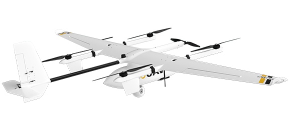
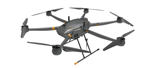
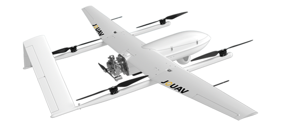
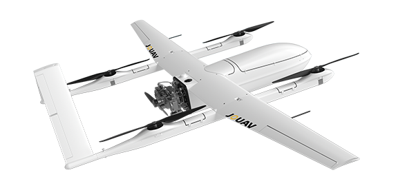
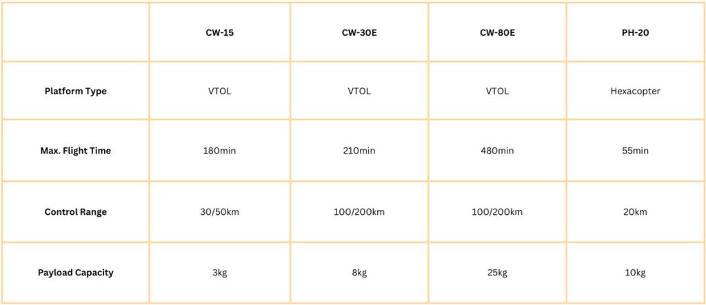
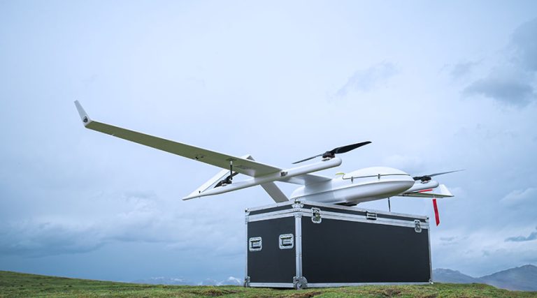
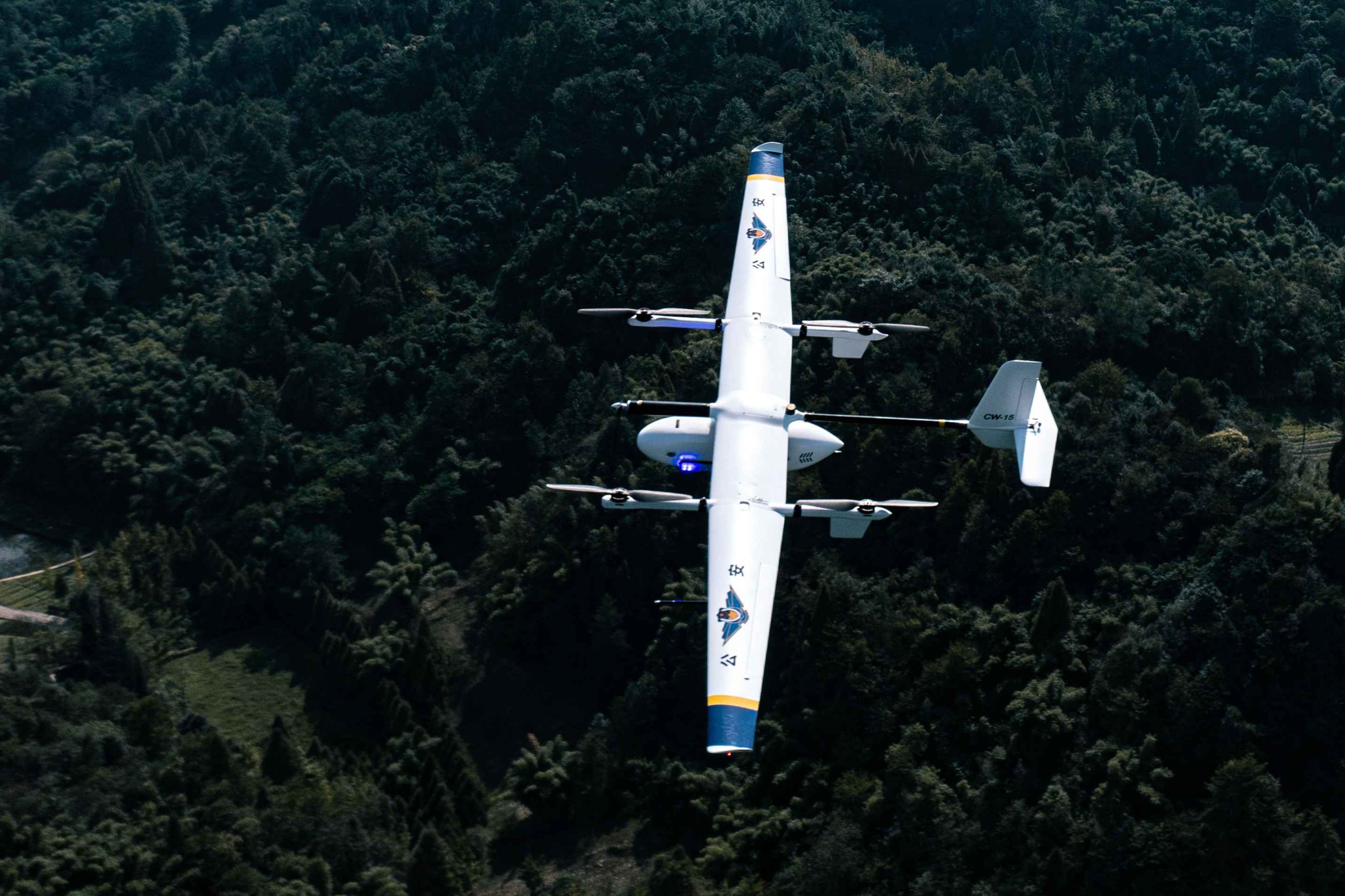
JOUAV Drones – Customizable for Every Mission
JOUAV offers a wide range of VTOL and multirotor drones, equipped with advanced payloads and extended flight times, designed to meet the specific needs of public safety agencies.

1-25kg Payload
Capable of carrying payloads from 1 to 25 kg, including LiDAR, speakers, gas sensors, and emergency kits.

10h Endurance & 200km Range
Up to 10 hours of flight time and a 200-kilometer range, JOUAV drones excel in long-distance missions.

5 mins Deployment
Designed for quick deployment, our drones can be launched or retracted in as little as 5 minutes.

Enhanced Safety
Equipped with advanced obstacle avoidance, ADS-B, and geo-fencing technology, ensuring safe and reliable autonomous operation.
Communication Payloads
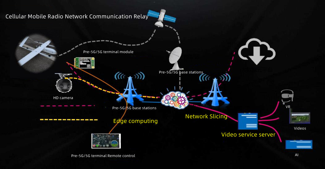

Satellite Communication: Maintain connectivity in remote or infrastructure-free environments.
Airborne Broadband Self-Organizing Network: Create instant mesh networks for field teams during outages.
Airborne PDT Base Station: Extend legacy public safety radio communications (e.g., TETRA, P25) from the sky.
LTE Communication Base Station: Restore cellular coverage for civilians and responders in disaster zones.
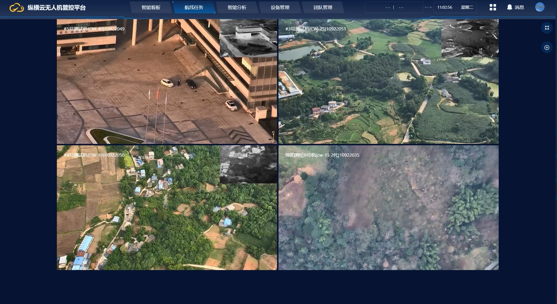
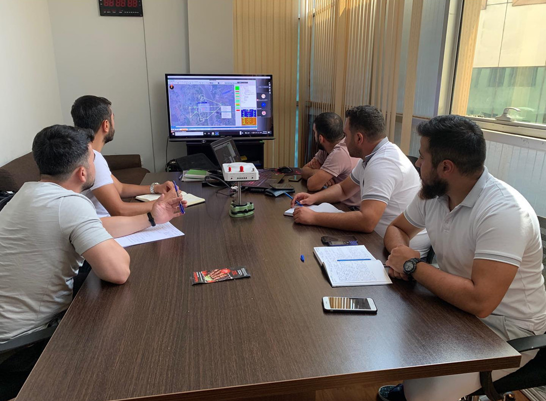
Unified Dashboard
A single, customizable interface providing real-time control and monitoring of all JOUAV VTOL Hangar and drone operations. It consolidates live video, telemetry, flight planning, and hangar status, enabling rapid decision-making through streamlined data visualization.
Secure Communication
End-to-end AES-128/256 encryption protects all data transmissions, ensuring secure and reliable communication for sensitive operations. Role-based access and audit trails maintain data integrity and prevent unauthorized access.

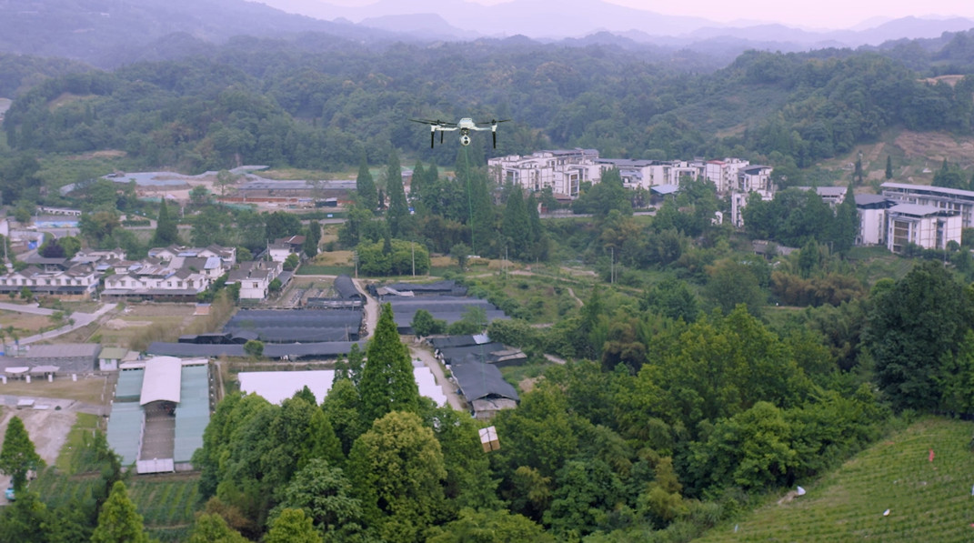
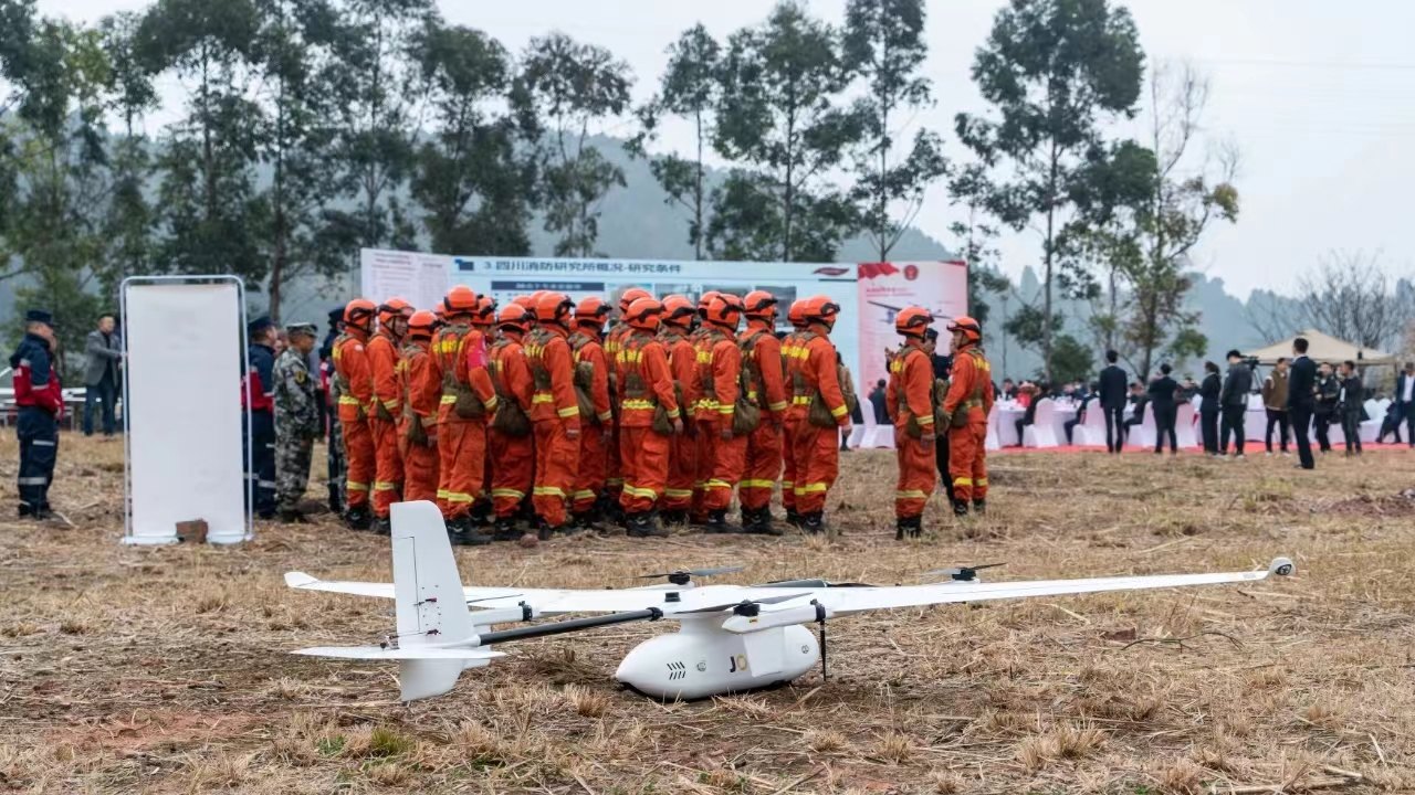
JOUAV Public Safety Drone Use Cases
During the deep Qinghai autumn, telltale plumes of smoke rise from the grassland in the east.
Qinghai is a landlocked province in northwest China. Its eastern region is highland pastoral areas i
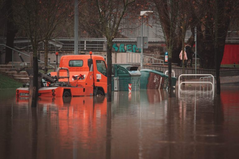
Home to an estimated population of 99.41 million residents, Zhengzhou is the capital and largest city of Henan, China. Between 17 and 31 July 2021, Zhengzhou experienced catastrophic flooding as a res
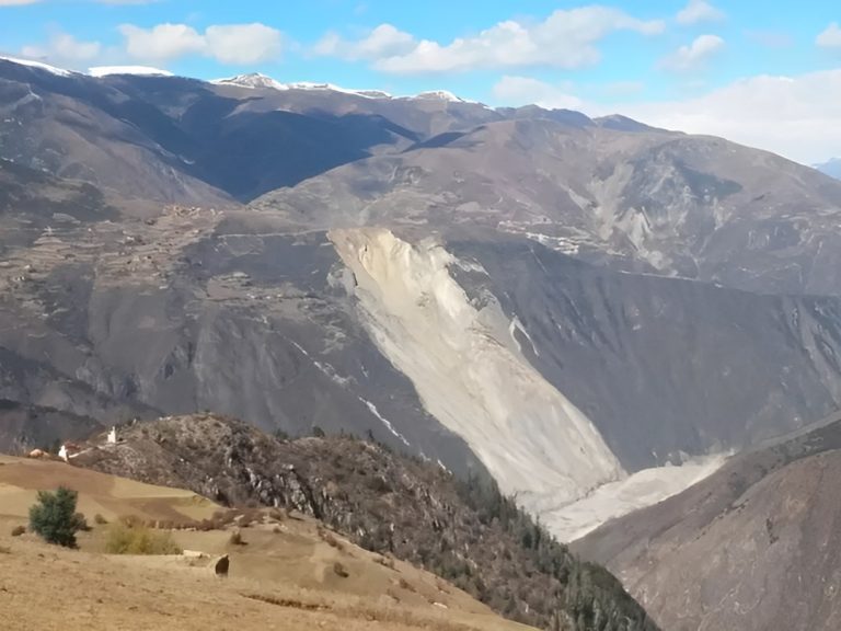
The Jinsha River, as the upper reaches of the Yangtze River, flows through four provinces including Qinghai, Tibet, Sichuan, and Yunnan in western China. On Oct. 11, 2018, a large-scale landslide occu
China, the largest producer of marine fisheries in the world, has a long coastline and a huge marine fishing fleet. China has always attached great importance to the conservation and sustainable use o
Guangdong Police Dept is increasingly using AI drones to monitor port areas and coastal areas. This involves not only surveillance to combat contraband smuggling, but also providing aerial assistance
Open Ecosystem
JOUAV’s UAV platform features an open hardware/software architecture, enabling customization of payloads, sensors, and flight controls. It supports industry-leading video transmission standards (RTSP, RTMP, GB28181, UDP) and integrates directly with third-party cloud platforms, legacy dispatch systems, and GIS tools via APIs and MQTT protocols.
Public Safety Expertise
Solutions are co-engineered with emergency operations veterans to meet mission-critical needs. Features like rapid deployment in extreme weather, dual-payload operations (e.g., live-video streaming + LiDAR mapping), and ruggedness for high-stakes scenarios (active shooter incidents, hazmat responses) reflect first responders’ priorities.
Global Trust
JOUAV’s technology has saved lives in disasters worldwide. In April 2024, Guangdong flood response teams used JOUAV CW-15 drones to capture 0.05-meter resolution imagery over 10 km², generating emergency maps that identified landslide risks, building damage, and road closures. These insights directly guided evacuations and resource allocation.
Training & Support
JOUAV ensures operational readiness through certified training, hands-on simulations, and continuous support. Agencies receive pilot, operator, and IT training tailored to mission scenarios. Beyond initial setup, JOUAV offers 24/7 technical support during emergencies, plus maintenance, software updates, and sensor calibration to keep systems mission-ready year-round.
What is a Drone as a First Responder (DFR) Program?
Imagine knowing what's happening at the scene of an emergency before first responders arrive. This real-time intelligence is the core of a Drone as First Responder (DFR) program.
By rapidly deploying drones to 911 call locations, police officers and other emergency personnel gain crucial situational awareness, enabling them to prepare for what they'll encounter.
How Does It Work?
When an emergency is reported, a remote operator—trained to pilot drones from a central control center—immediately launches a drone to the scene.
These drones typically reach the incident location faster than traditional ground vehicles, providing live video feeds and critical data to the command center.
This aerial perspective allows officers on the ground to prepare for what they might encounter, ultimately improving response times and resource allocation.
For example, in Chula Vista, California, the first U.S. city to implement a DFR program in 2018, drones have been deployed in over 4,000 emergency calls, consistently arriving in less than 2.5 minutes.
The drones have significantly reduced unnecessary patrol deployments, with over 1,000 instances where the drone footage determined that no physical police presence was necessary. This saves resources and enhances safety by preventing officers from entering potentially dangerous situations.
Despite the clear benefits, Drone as a First Responder programs face regulatory hurdles. In most cases, drones must operate Beyond Visual Line of Sight (BVLOS) and sometimes over people, both of which are restricted by the FAA’s Part 107 rules.
This means that police departments must go through a lengthy approval process, such as securing a Certificate of Authorization (COA), to operate drones in these advanced capacities.
Benefits of Using Drone in Public Safety
Beyond immediate response, the integration of drones into public safety operations offers a multitude of long-term advantages.
Rapid Response Times
One of the most critical benefits is the speed of deployment. Drones can be launched almost immediately upon receiving an emergency call, often reaching the scene faster than traditional ground units. This swift response enables decision-makers to act quickly—potentially saving lives and reducing overall damage before responders even arrive on the scene.
Enhanced Situational Awareness
Equipped with high-definition cameras, thermal imaging, and various advanced sensors, drones provide a comprehensive aerial view of any incident. This bird’s-eye perspective allows public safety agencies to assess unfolding events in real time—whether tracking a suspect, evaluating an active shooter situation, or surveying disaster zones. The clear, live feed ensures that first responders have the most accurate and up-to-date information, greatly improving strategic planning and execution.
Improved Officer and Public Safety
By serving as the eyes in the sky, drones allow officers to gauge potential dangers from a safe distance. This remote reconnaissance minimizes the need for personnel to enter hazardous environments unnecessarily. With drones offering a preliminary assessment of a scene, responders can better determine when and how to engage—thereby reducing risk to both officers and the public.
Efficient Resource Allocation
Drones contribute significantly to operational effectiveness by delivering immediate, actionable intelligence to command centers. With precise, real-time data, emergency services can allocate resources more accurately, ensuring that the right personnel and equipment are deployed exactly where they’re needed. This targeted response not only improves overall operational efficiency but also optimizes the use of limited resources.
Cost-Effective Operations
In comparison to traditional aerial assets like helicopters, drones provide a more affordable solution for large-scale operations. They cover vast areas quickly and incur lower operational and maintenance costs. Over time, the financial savings—from reduced manpower to minimized equipment usage—can be substantial, making drone integration a cost-effective choice for public safety agencies.
Key Applications of Public Safety Drones
From enhanced situational awareness and improved resource allocation to increased safety for both responders and the public, the utilization of drones can revolutionize traditional emergency response protocols.
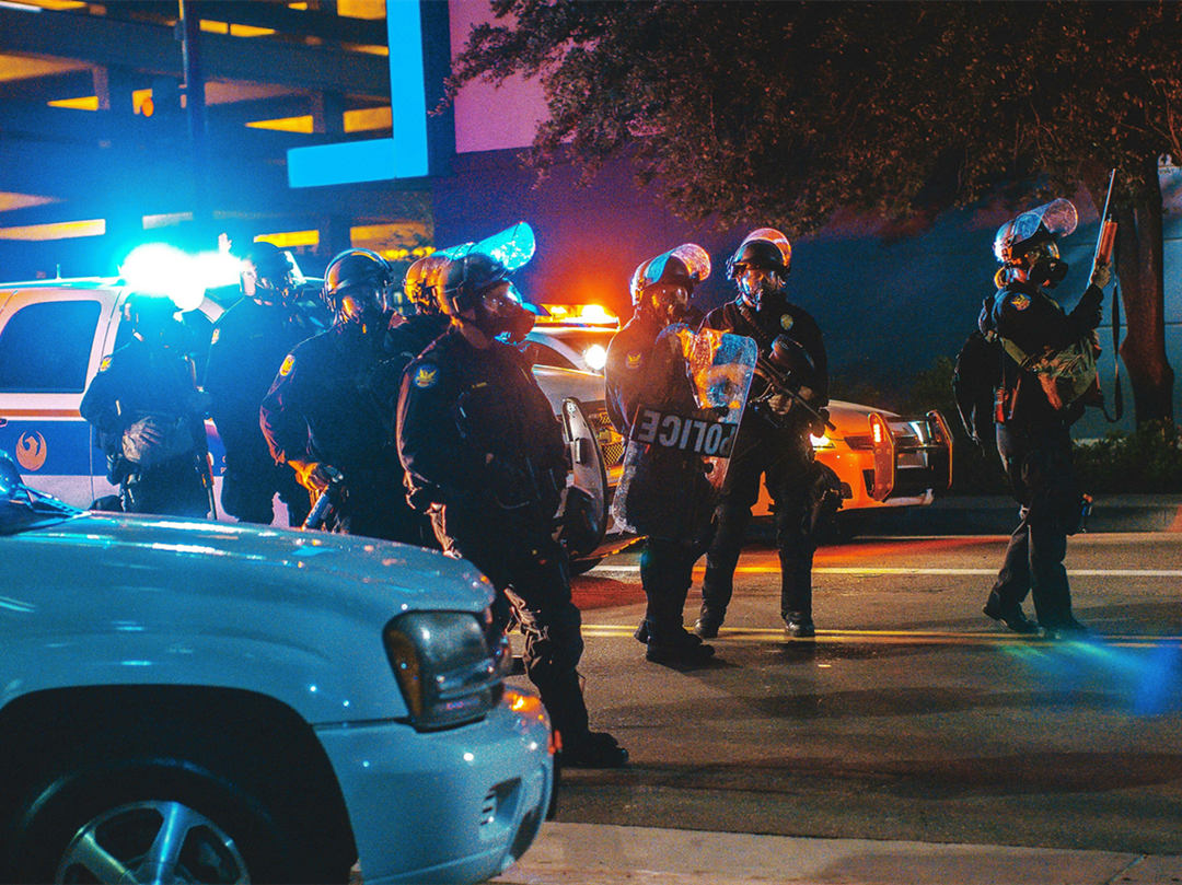
Law Enforcement
- Overwatch Operations: Deploy police drones to monitor large events, protests, or crime hotspots, providing commanders with live aerial visuals to coordinate patrol units and preempt threats.
- Suspect Pursuit: Use thermal imaging and AI-powered tracking to locate fleeing suspects in low-light conditions, minimizing officer exposure during high-stakes apprehensions.
- Crime Scene Documentation: Capture high-resolution images/videos of crime scenes for forensic analysis, ensuring evidence integrity and reducing human interference.
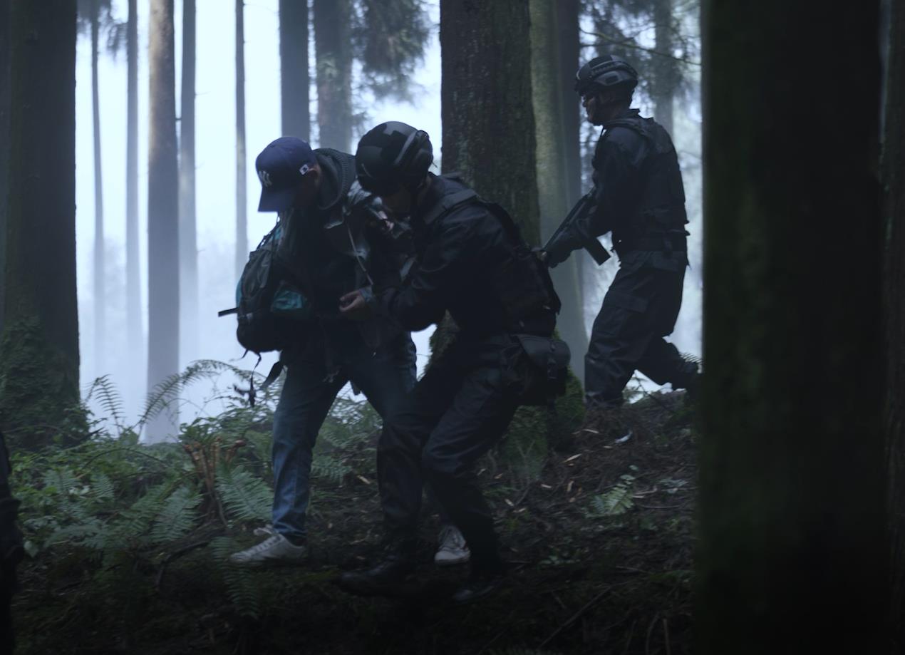
Search and Rescue (SAR)
- Locating Missing Persons: Deploy thermal cameras to detect body heat signatures in forests, mountains, or waterways, expediting searches during critical time windows.
- Disaster Area Assessments: Survey hazardous zones (e.g., earthquake rubble, avalanche debris) to identify safe entry/exit routes for ground teams.
- Distress Signal Detection: Identify flares, PLBs, or emergency beacons from afar, narrowing down search areas.
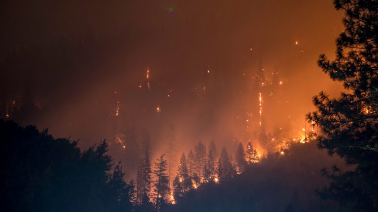
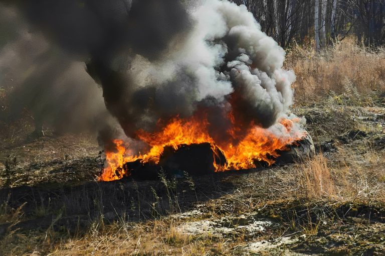
Firefighting
- Hotspot Detection: Use thermal imaging to identify smoldering areas within structures, preventing rekindling and enabling targeted suppression.
- Wildfire Monitoring: Track fire spread in real time, assisting in evacuation planning and containment line strategies.
- Post-Fire Damage Assessment: Generate 3D maps of charred areas to identify structural risks (e.g., landslides) and prioritize rebuilding efforts.
Drone as a First Responder (DFR)
- Incident Scene Assessment: Dispatch drones to inspect hazardous environments (e.g., gas leaks, collapsed buildings) for safety risks, allowing responders to adapt strategies on the fly.
- Emergency Payload Delivery: Transport defibrillators, first aid kits, or communication devices to remote or inaccessible locations.
- Lighting/Signaling: Use LED-lit drones to guide survivors in smoke-filled buildings or mark safe zones during evacuations.
Emergency Medical Services (EMS)
- Rapid Medical Transport: Prototype drone ambulances (e.g., Volocopter) transport patients over short distances (e.g., rural roads) to hospitals.
- Telemedicine: Facilitate live video consultations between field medics and specialists for remote diagnoses.
- Supply Chain Support: Deliver blood, vaccines, or antivenoms to isolated areas during emergencies.
Disaster Response
- Damage Mapping: Create 3D LiDAR maps of affected areas to identify infrastructure damage and prioritize repairs.
- Resource Allocation: Analyze real-time aerial data to distribute supplies (e.g., food, water) to the most impacted zones.
- Survivor Detection: Combine thermal imaging with AI to locate individuals trapped under debris.
How to Start a Public Safety Drone Program?
Implementing a successful public safety drone program involves more than just acquiring the necessary equipment. It requires a comprehensive approach.
1. Define Objectives and Assess Needs
Begin by identifying the specific challenges your agency faces, such as rapid response, disaster management, or surveillance. Establish clear, measurable goals—like reducing response times or improving officer safety—that will help determine the necessary drone capabilities (e.g., high-resolution cameras, thermal imaging, or extended flight endurance).
2. Establish a Legal and Regulatory Framework
A major hurdle for public safety drone operations is navigating regulatory restrictions. Many regions, including under the FAA’s Part 107 in the U.S., prohibit operations like flying Beyond Visual Line of Sight (BVLOS), over people, over moving vehicles, and at night. To legally operate in these conditions, you can choose one or a combination of the following paths:
- Obtain Part 107 Waivers: Request waivers for prohibited operations by submitting a comprehensive safety case that demonstrates risk mitigation.
- Secure a Certificate of Authorization (COA): This alternative allows you to operate under different regulatory guidelines tailored for public safety.
- Combination Approach: Leverage both methods to maximize flexibility and cover all operational scenarios.
Crafting a robust legal framework is crucial. Work closely with legal advisors and consult with regulatory authorities to ensure your program meets all local and international standards.
3. Prioritize Safety in Technology Selection
Safety is paramount. Select drone platforms that feature advanced obstacle detection and avoidance systems, autonomous flight capabilities, and proven performance in BVLOS or over-people operations. It’s beneficial to choose drones with a strong track record of safe operations, as this can improve your chances of securing regulatory approvals.
4. Develop a Comprehensive Operations Manual
An in-depth operations manual is essential for establishing credibility with regulators and ensuring smooth operations. Your manual should detail:
- Risk Mitigation Strategies: How your program will safely manage BVLOS, over-people, and night operations.
- Communication Protocols: Clear guidelines for real-time data transmission, coordination with emergency responders, and incident management.
- Emergency Procedures: Defined actions for system failures, lost signals, or unexpected obstacles.
Using successful templates or consulting with agencies that have already implemented their programs can help you build a robust manual.
5. Invest in Pilot Training and Expertise
Ensure your remote operators receive advanced training, particularly in specialized areas like BVLOS and operations over people. Regular training updates and documented pilot proficiency are critical for both safe operations and successful regulatory applications.
6. Engage with Regulatory Authorities
Establish open lines of communication with regulatory bodies early in the process. Leverage available resources and guidance from authorities such as the FAA, EASA, or local equivalents. Studying successful waiver applications and incorporating their best practices can significantly bolster your safety case and improve your likelihood of receiving approval.
7. Consider Third-Party Partnerships
If resources allow, consider hiring experienced third-party consultants who specialize in public safety drone programs. Organizations like JOUAV, DJI Enterprise, or Skydio can provide valuable expertise in equipment selection, training, and navigating regulatory processes—helping your agency launch a successful and compliant program more efficiently.
8. Pilot and Scale Gradually
Start with a pilot program to test your operational concepts on a smaller scale. Monitor performance metrics closely, gather feedback from field operators, and refine your procedures before a full-scale rollout. This phased approach not only minimizes risk but also allows you to adjust strategies based on real-world performance.
FAQ
What is a Public Safety Drone?
A public safety drone is a specialized unmanned aerial vehicle (UAV) designed to support emergency response, law enforcement, firefighting, and disaster management operations.
These drones are equipped with advanced sensors, cameras, communication systems, and navigation tools tailored to meet the demands of high-stakes missions.
How Are First Responders Using Drone?
Public safety agencies leverage drones for diverse critical tasks:
- Search and Rescue (SAR): Thermal imaging and obstacle avoidance enable locating missing persons in rugged terrain or at night. For example, drones have been used to find survivors in avalanches or collapsed buildings.
- Traffic Enforcement: High-speed cameras paired with license plate recognition (LPR) identify traffic violations and accidents, reducing response times.
- Disaster Response: Damage assessment via multispectral sensors after earthquakes, floods, or wildfires. Drones also deliver emergency supplies (e.g., defibrillators) to inaccessible areas.
- Perimeter Patrol: Continuous monitoring of critical infrastructure (e.g., pipelines, borders) to detect threats like illegal activity or structural damage.
- Crime Scene Investigation: Aerial photography and 3D mapping preserve crime scenes and collect evidence without compromising officer safety.
Are Drones Effective for Police Operational?
When deployed strategically, drones significantly enhance police operations by providing aerial oversight of large events and high-crime areas. Their continuous surveillance deters criminal activity, and the live footage supports real-time decision-making and serves as court-admissible evidence.
In dangerous situations, such as active shooter scenarios, drones enable targeted searches and optimize resource use, reducing the need for extensive ground patrols.
Can Fire Departments Benefit from Drones?
Drones equipped with thermal imaging help detect fires, map hotspots, and monitor flame spread, aiding resource allocation during wildfires. They also assist in victim search by navigating hazardous environments and reducing risks by monitoring firefighters' health. Post-fire, drone imagery supports structural damage assessment for repairs and insurance.
Additionally, drones can deliver hoses or extinguishing agents to otherwise inaccessible areas.
What are the Legal Requirements for Flying a Public Safety Drone?
Laws vary by country but generally include:
- Registration: In the U.S., drones under 250g (without registration) are exempt, but those above require FAA Part 107 certification. The EU mandates registration for drones weighing over 250g.
- Operator Certification: Public safety operators must complete training courses (e.g., FAA’s Remote Pilot Certificate).
- Airspace Restrictions: Drones must fly below 400 feet (120m) in most U.S. airspace, avoid restricted zones (e.g., airports), and comply with nighttime flying rules.
- Privacy Laws: Data collected via drones (e.g., images, videos) must be stored securely and deleted when no longer needed. In the EU, the General Data Protection Regulation (GDPR) applies.
- Emergency Waivers: Public safety agencies may obtain exemptions for missions critical to public safety (e.g., missing persons searches).
What are the Concerns about Privacy and Public Safety Drones?
Despite the proven benefits of drones in public safety, privacy concerns remain. Their advanced capabilities can record sensitive data and images, possibly infringing on private property or collecting information without consent. Additionally, unauthorized access to this data poses a risk of misuse.
There is also the potential for abuse if law enforcement uses drones for unauthorized purposes, like tracking political activists. A lack of transparency in drone operations can further undermine public trust.
More information about JOUAV and our drones
Provide the suitable solution for your needs
Help for your project promotion
Get a product quote