Chengdu, China – March 14 – Chengdu JOUAV Automation Technologies Co., Ltd. (JOUAV) marked a milestone in the low-altitude economy sector with its product launch event, “Low-Altitude Economy: Embarkin
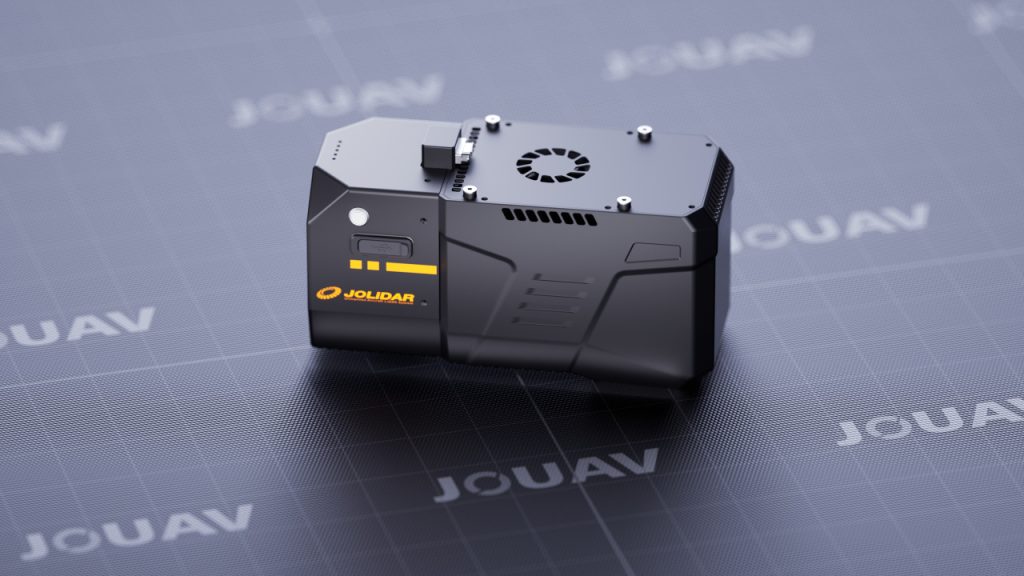
Chengdu, China - July 8, 2024 - JOUAV today announced the launch of the JoLiDAR-120G, a high-end, long-range LiDAR system designed for maximum efficiency and adaptability across various surveying and mapping applications.
Lightweight Design, Enhanced Compatibility
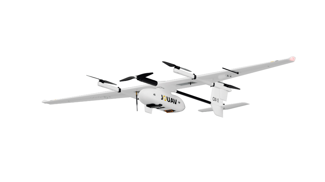
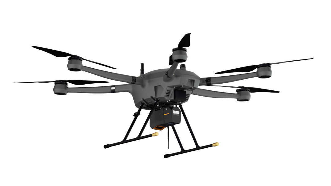
Weighing only 2.5kg (including the camera), the JoLiDAR-120G is a remarkably lightweight LiDAR system. This facilitates compatibility with popular JOUAV drone platforms, including the JOUAV CW-15 VTOL drone and the PH-20 multirotor drone. This versatility empowers users to choose the most suitable drone for their specific mission requirements.
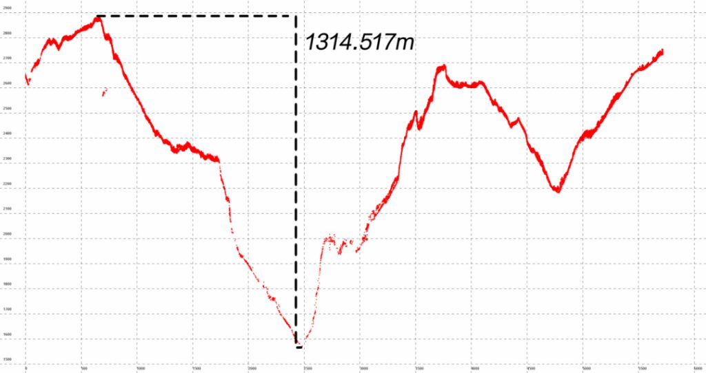
1800m Range Efficiency for High-Difference Terrains
The JoLiDAR-120G boasts a maximum range of 1800 meters, making it perfect for surveying high-difference terrains such as mountainous areas. It effectively detects valley features, reducing the need for additional flights and significantly improving field operation efficiency.
In rigorous tests, the CW-15 equipped with the JoLiDAR-120G achieved a maximum point cloud height difference of 1314.517 meters at a relative flight altitude of 260 meters, with measured distances exceeding 1500 meters.
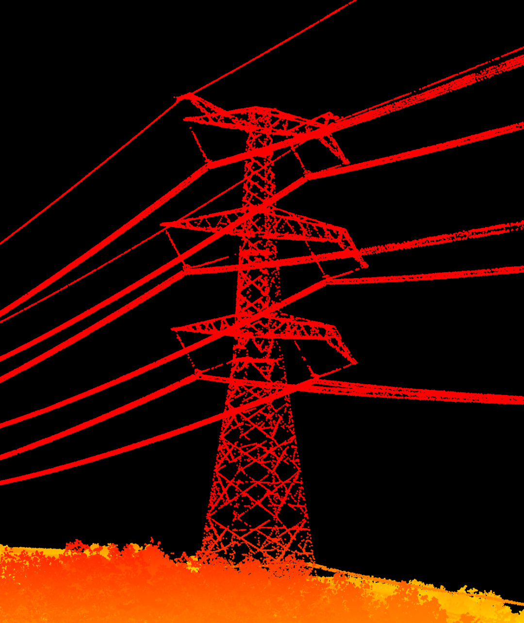
Transmission tower point cloud detail captured by single line LiDAR
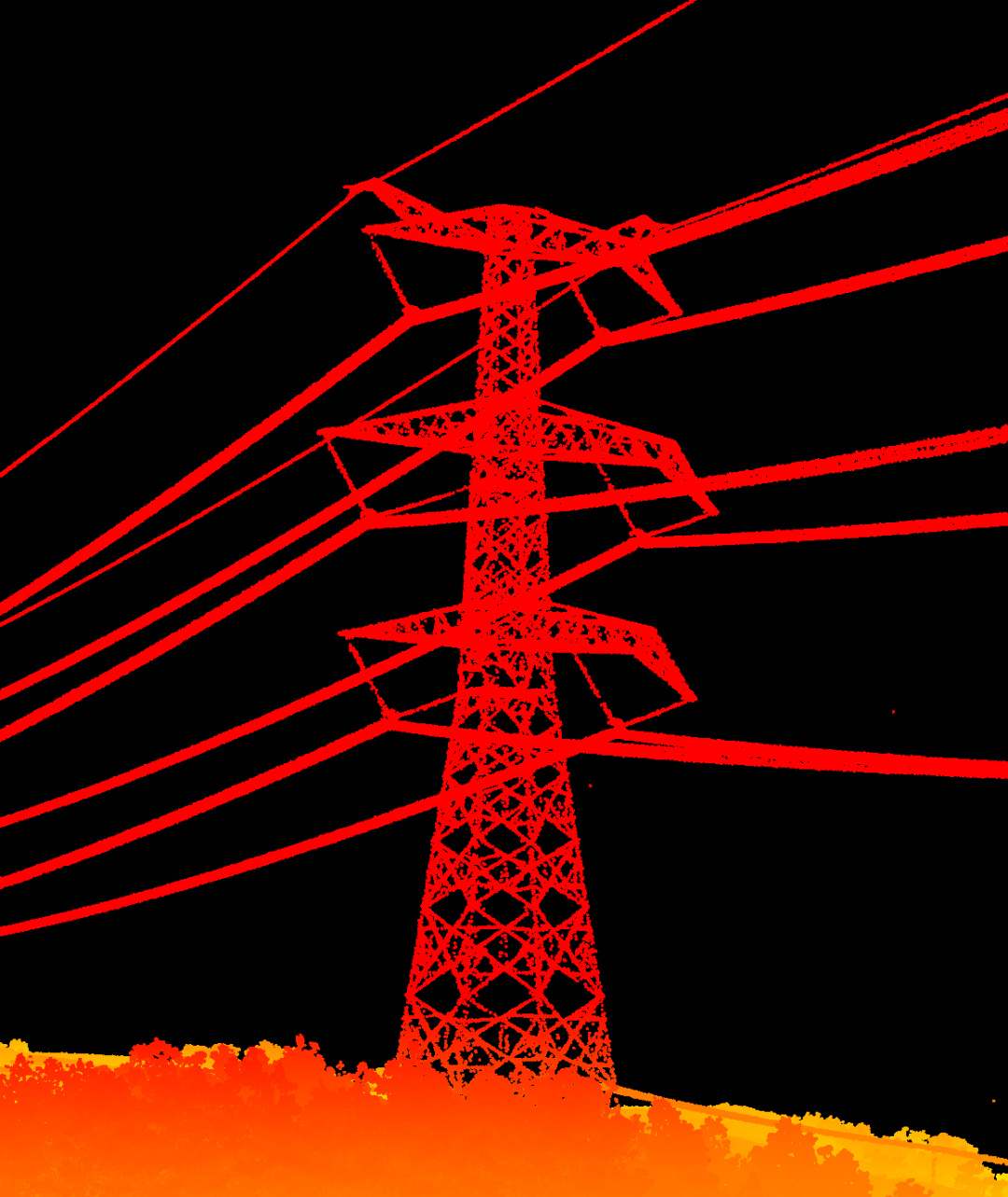
Transmission tower point cloud details captured by JoLiDAR-120G
3-Directional Scanning for Comprehensive Data Collection
The JoLiDAR-120G features a unique three-directional scanning capability, with measurement beams scanning from a forward tilt of +10° to vertical downward, to a backward tilt of -10°.
This comprehensive scanning ability provides thorough data collection of surface features, including building facades and power poles, ensuring complete 3D models of surveyed areas.
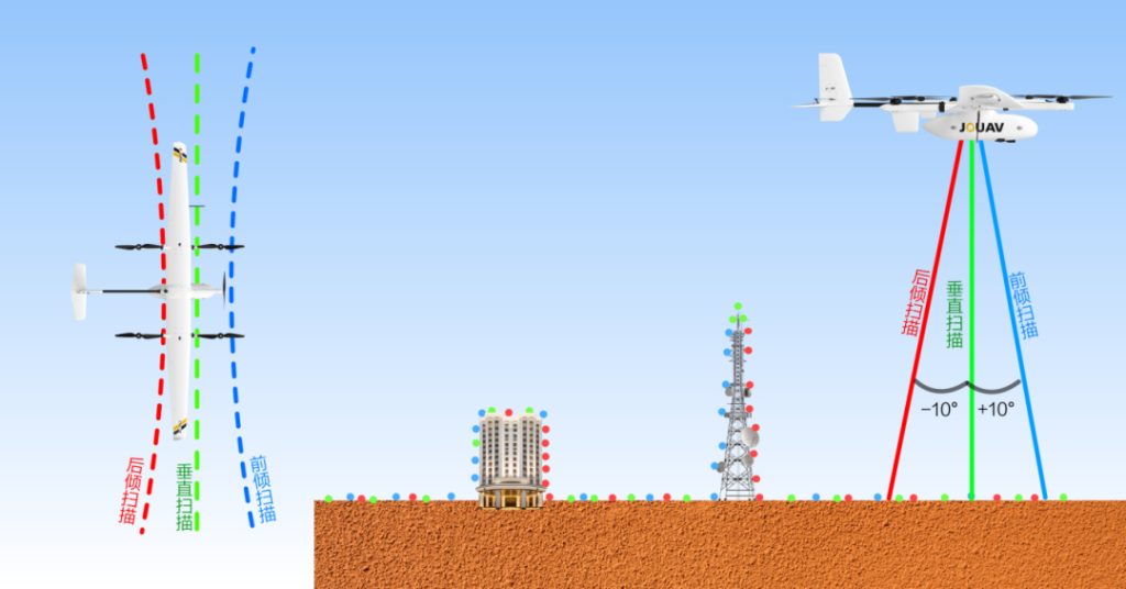
3 directional scanning working principle of JoLiDAR-120G
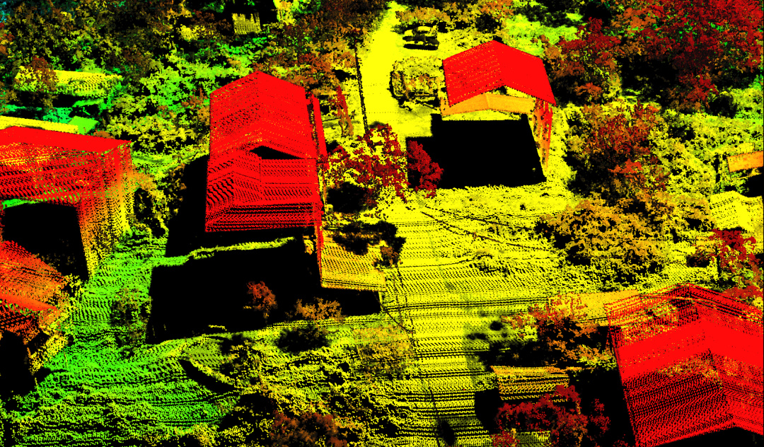
House point cloud detail captured by single-line LiDAR
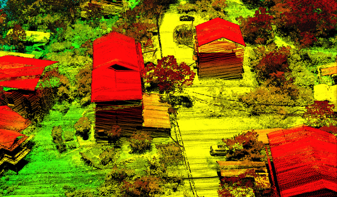
House point cloud detail captured by JoLiDAR-120G
16 Return Detection for Enhanced Accuracy
Supporting up to 16 returns with multi-cycle return processing (MTA), the JoLiDAR-120G enhances its ability to penetrate vegetation and other obstacles, ensuring high data accuracy and reliability.
This makes it invaluable for forestry, agriculture, and environmental monitoring applications.
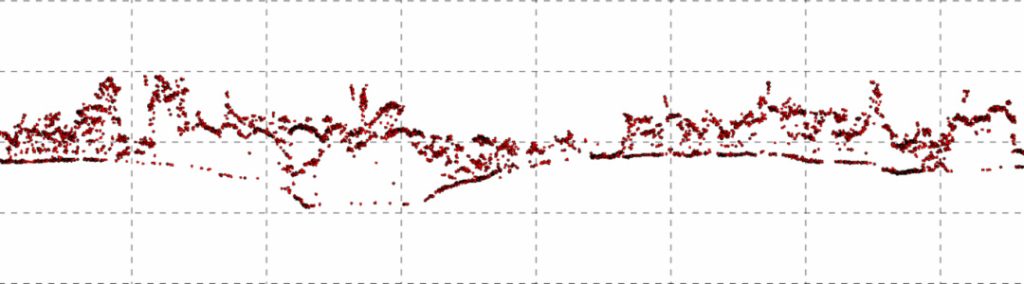
Single-line LiDAR penetration effect
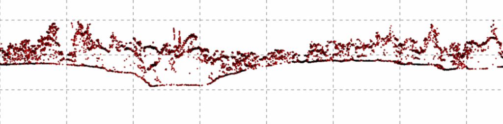
JoLiDAR-120G penetration effect
60° and 75° FOV Options for Tailored User Scenarios
Offering 60° and 75° field of view options, the JoLiDAR-120G adapts to different mapping needs. The 60° option is ideal for strip mapping scenarios such as power lines, roads, and rivers, while the 75° option enhances area mapping efficiency without compromising point density.
Note: Scan width (60°) = 1.155 × relative flight altitude / Scan width (75°) = 1.535 × relative flight altitude.
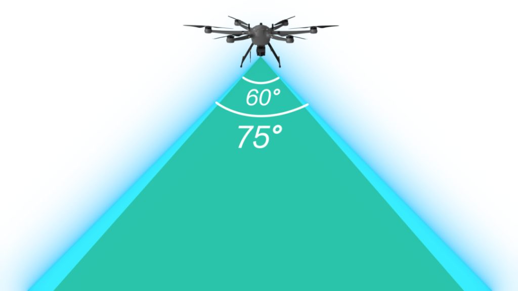
60° and 75° field of view options for JoLiDAR-120G
True Color Point Cloud Real-Time Modeling
The JoLiDAR-120G supports real-time modeling and point cloud classification, producing fast, low-latency, and high-precision data on the fly. It can generate industry-specific reports, such as real-time obstacle reports, ensuring timely and accurate insights.
Upgraded JoLiDAR Point Cloud Processing Software
JOUAV has significantly upgraded its JoLiDAR point cloud processing software, introducing new features tailored for the surveying, mining, and electrical power industries:
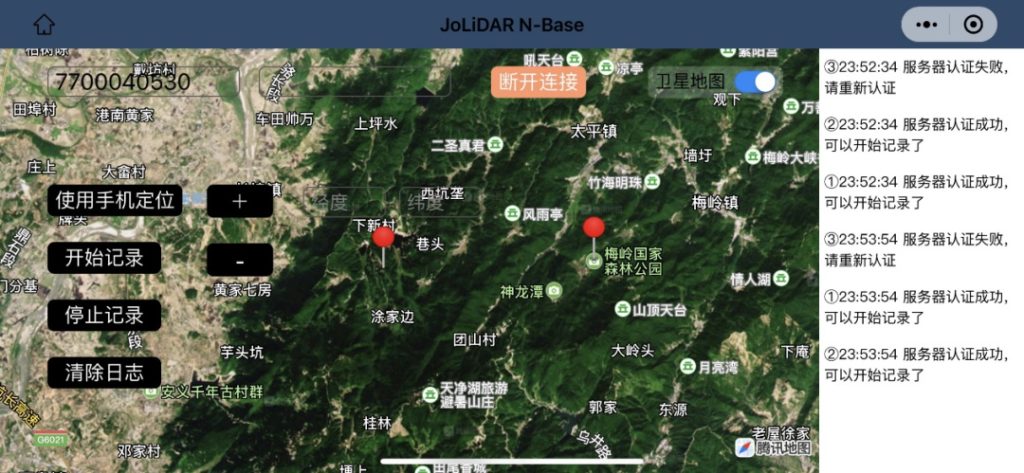
Base-Station-Free Service
The upgraded service includes the N-Base cloud station and high-precision POS cloud solution. The N-Base cloud station allows users to set up virtual stations and control data collection via a mobile app, which is beneficial for large survey areas and long baseline strip operations. This ensures differential precision without the need for traditional base stations.
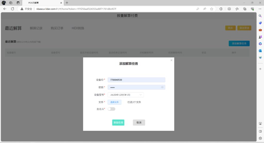
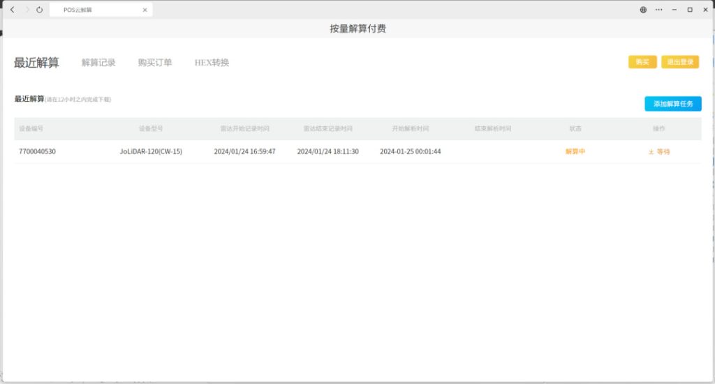
High-Precision POS Cloud Solution
This feature eliminates the complex trajectory calculation process. Users can upload mobile station data, which will automatically link to N-Base cloud station data, enabling high-precision trajectory calculation with a single click.
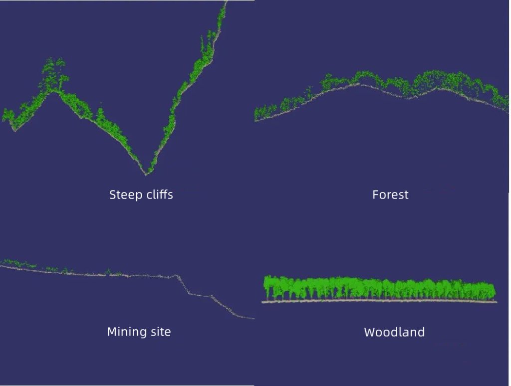
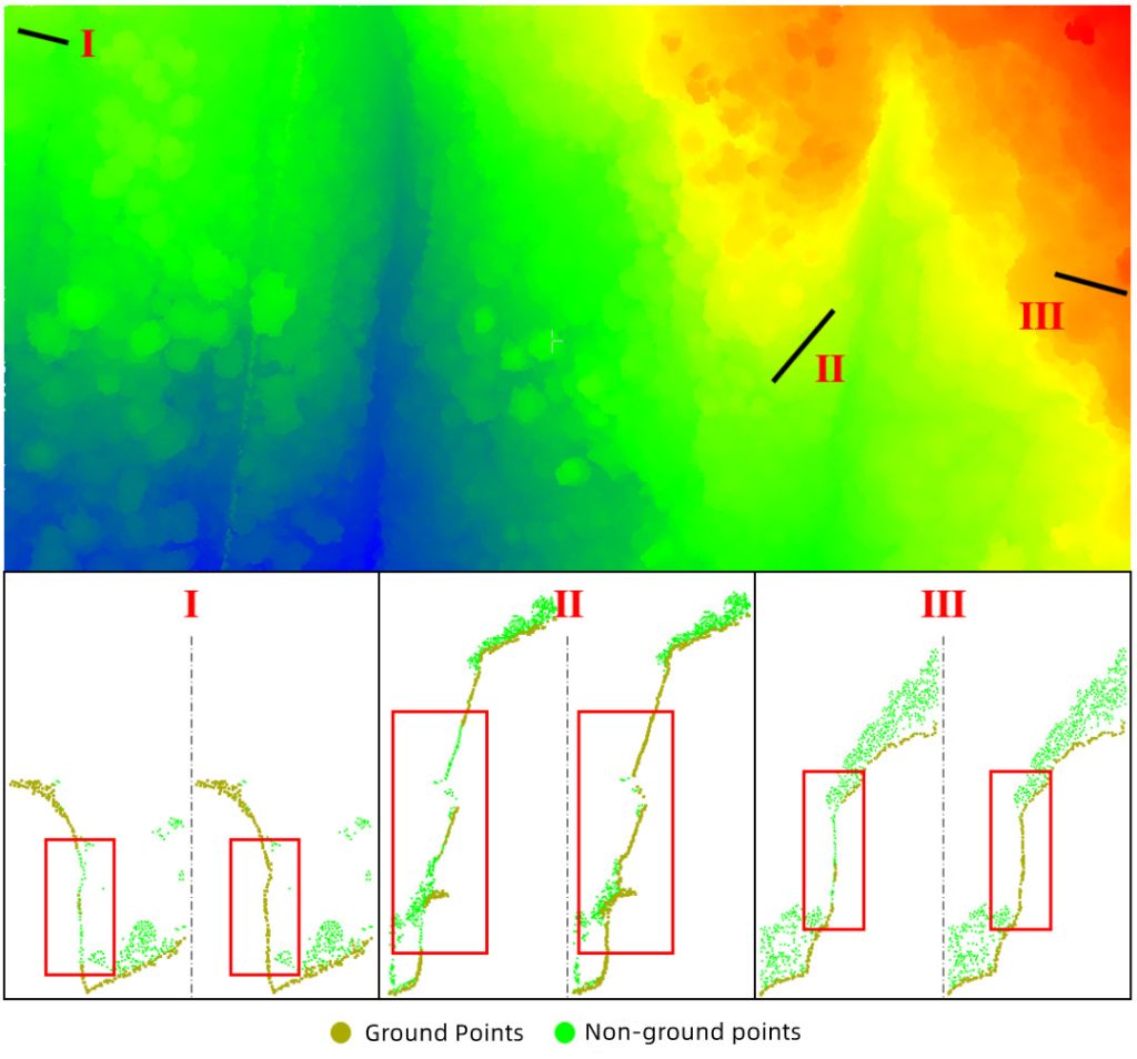
Adaptive Ground Filtering
The newly upgraded ground filtering system adapts to various terrains such as steep cliffs, low shrubs, stepped terrains, and dense vegetation. This significantly reduces the need for manual editing and provides convenience for creating digital elevation models and contour mapping.
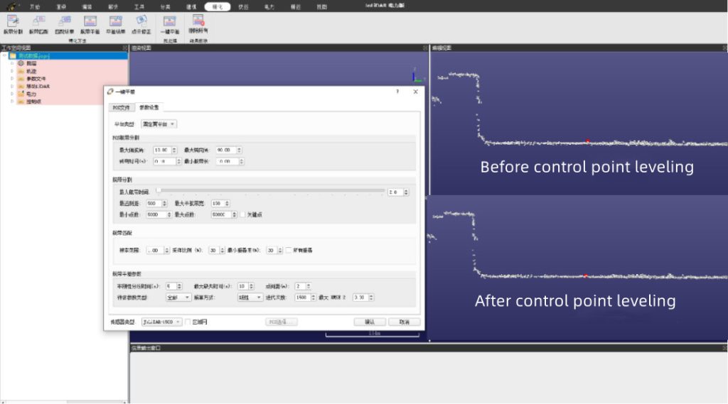
One-Click Leveling
This feature supports one-click leveling for multiple models and missions, including the addition of control points to improve both relative and absolute accuracy. It doubles the efficiency compared to previous versions.
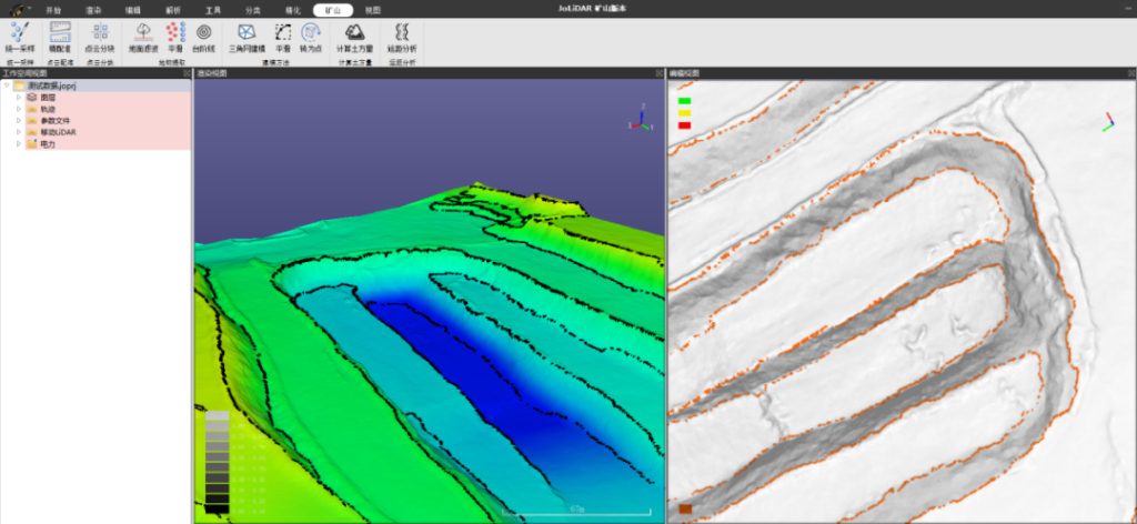
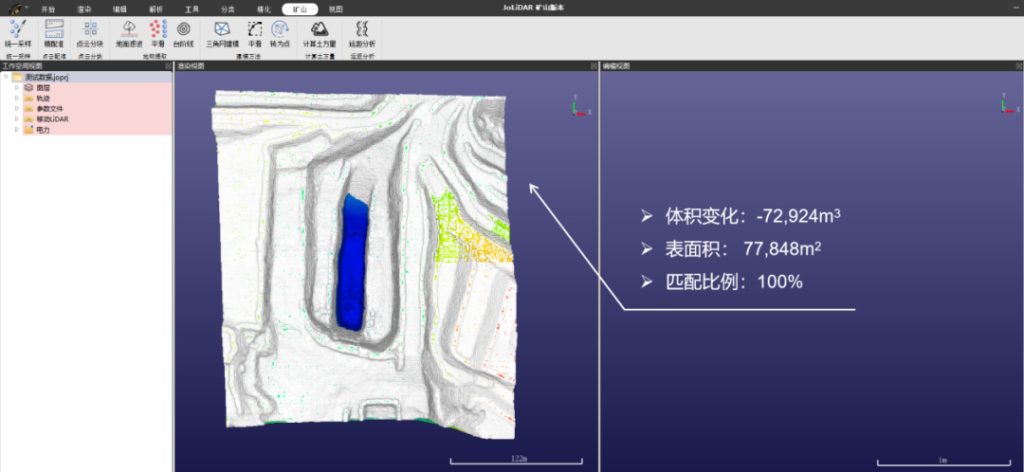
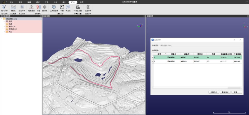
New Mining Version
The JoLiDAR point cloud processing software introduces a mining module tailored for open-pit mining applications. New features include:
- Step Line Extraction: Automatically identifies mining step lines with a single click, eliminating the need for manual drawing.
- Volume Calculation: Automatically calculates excavation and fill volumes in the mining area, supporting volume change calculations before and after excavation.
- Haul Distance Calculation: Creates transportation routes and automatically calculates both planar and 3D haul distances.
The JoLiDAR-120G is set to revolutionize the LiDAR industry with its unmatched precision, flexibility, and efficiency. Its advanced features and upgraded software make it the ideal choice for a wide range of applications, from surveying and mining to environmental monitoring and power line inspections.
Read More
Recently, the Sichuan Provincial Department of Science and Technology announced the winners of the 2023 Sichuan Provincial Science and Technology Progress Award, with JOUAV receiving the prestigious F
On October 31, the 2024 China Marine Economy Expo (CMEE), themed “Open Cooperation, Win-Win Sharing,” officially commenced in Shenzhen, Guangdong Province. Key attendees included Sun Shuxi

JOUAV Product News and Use Cases
Fixed-Wing VTOL Drones Insights and Industry Trends
Invitations to online demo events