JOUAV Spearheads Earthquake Rescue Operations in Gansu
Jishishan County, Gansu Province, China - In the aftermath of the devastating 6.2 magnitude earthquake that struck Jieshishan County in Gansu Province, China, on December 18, 2023, JOUAV showcased unparalleled social responsibility by swiftly deploying its advanced drone technology to aid in emergency rescue operations. The challenging plateau terrain and severe cold conditions posed significant obstacles, but JOUAV's UAVs demonstrated exceptional performance, providing crucial support in the face of adversity.
Recognizing the situation's urgency, JOUAV rapidly assembled a specialized emergency rescue team comprising 17 skilled professionals and a versatile fleet of five drones encompassing surveying and mapping, monitoring, and airborne satellite communication guarantee categories. The team promptly deployed to Jishishan County to assist with the rescue efforts.
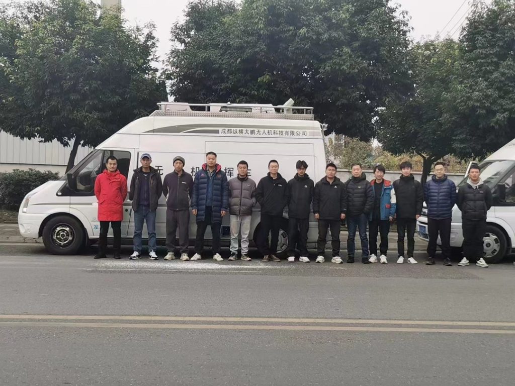
In the wake of the devastating Gansu earthquake, JOUAV's Emergency Rescue Team swiftly mobilized and courageously ventured to the front lines of the disaster relief efforts.
JOUAV's founder, CEO & general manager, Ren Bin, emphasized the company's commitment to leveraging technology for the greater good: "In the face of disaster, we always believe in the power of technology. JOUAV will do whatever it takes to support the disaster area with advanced drone technology."
Jishishan County, nestled at the intersection of the Loess Plateau and the Tibetan Plateau, presented unique challenges with altitudes ranging from 1,735 meters to 4,309 meters. Compounded by the recent cold snap, the rescue mission demanded exceptional capabilities. JOUAV's drones not only met but exceeded expectations, showcasing exceptional performance in both high altitude and extreme cold conditions.
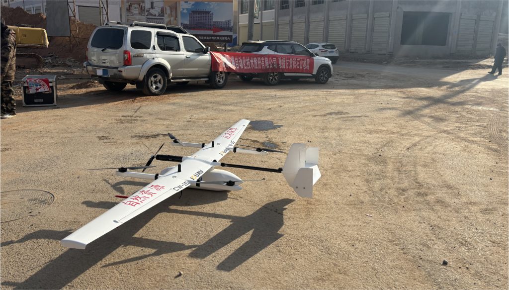
Pictures of JOUAV CW-15 drone operating at Gansu earthquake rescue site.
On the morning of the 20th, in collaboration with the Gansu Provincial Department of Natural Resources and the Emergency Mapping Center of the Academy of Surveying and Mapping Engineering, JOUAV's emergency rescue team employed their drones to conduct a high-definition digital orthophotos survey and mapping covering nearly 80 square kilometers of the earthquake-stricken area of Dahejia Township in Jishishan County.
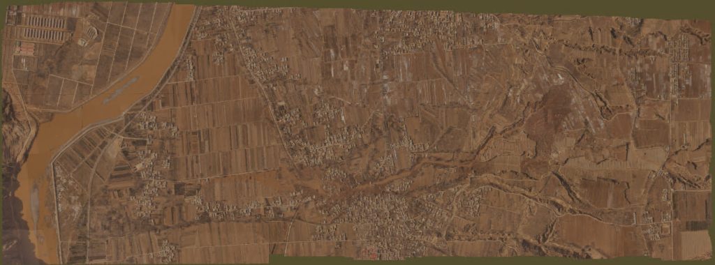
The orthophoto of the earthquake-stricken area in Dahejia Township, Jieshishan County, Gansu, China, offers a precise, distortion-free representation of the damage.
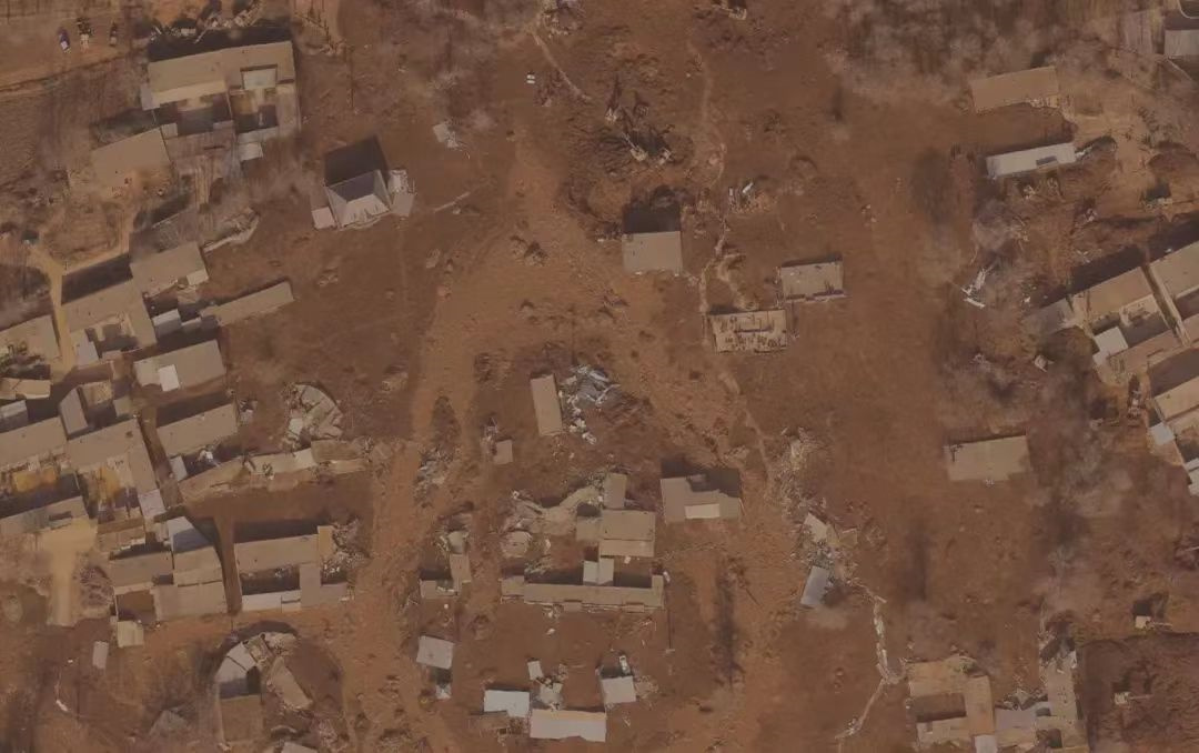
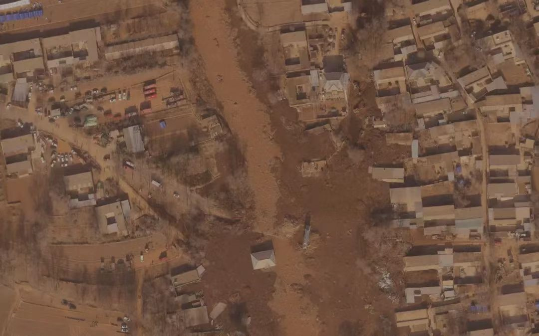
This invaluable data became the first batch of information in the disaster area, providing crucial insights for post-disaster relief and aiding command departments in comprehending the ground realities.
"Our goal is to provide the rescue command with the most accurate and timely data to ensure that rescue operations can be carried out more orderly and effective," stated Zhang Yongheng, the leader of JOUAV's emergency rescue team.
Following this success, JOUAV collaborated with the China Earthquake Emergency Search and Rescue Center to execute 3D oblique photography of 10 square kilometers of buildings in the disaster area.
Simultaneously, in partnership with the Gansu Provincial Seismological Bureau, JOUAV conducted oblique photography of mudslide sources, covering an operational range of 5 kilometers in length and 2 kilometers in width.
Let's take a look at the 3D model created from high-resolution images captured by the JOUAV drone's oblique camera system:
The utilization of high-quality oblique images captured by JOUAV's drone offers a detailed and realistic representation of the earthquake-stricken area. These images serve as the foundation for constructing a precise 3D model that not only captures the visible damage but also provides insights into the topographical changes and structural alterations caused by the seismic event.
JOUAV's unwavering commitment to technological innovation and social responsibility played a pivotal role in the success of the earthquake rescue mission, showcasing the critical role that drone technology can play in emergency response and disaster relief efforts. The company remains dedicated to advancing its capabilities to provide effective support in future crises.


