JOUAV’s Emergency Communication System Proven in Yunnan Rugged Terrain
In disasters, every second counts. So, reliable communication and real-time data are crucial. Natural disasters like earthquakes, floods, and landslides often destroy traditional infrastructure. This creates a communication void that hampers rescue operations.
To overcome this, the Yunnan Fire and Rescue Team partnered with JOUAV to test the CW-15 and CW-25E UAV communication relay systems. They aimed to boost emergency communication and disaster management.
This case study shows how JOUAV drones were vital in a simulated emergency in one of China's most rugged areas. They provided continuous communication, real-time data, and critical situational awareness.
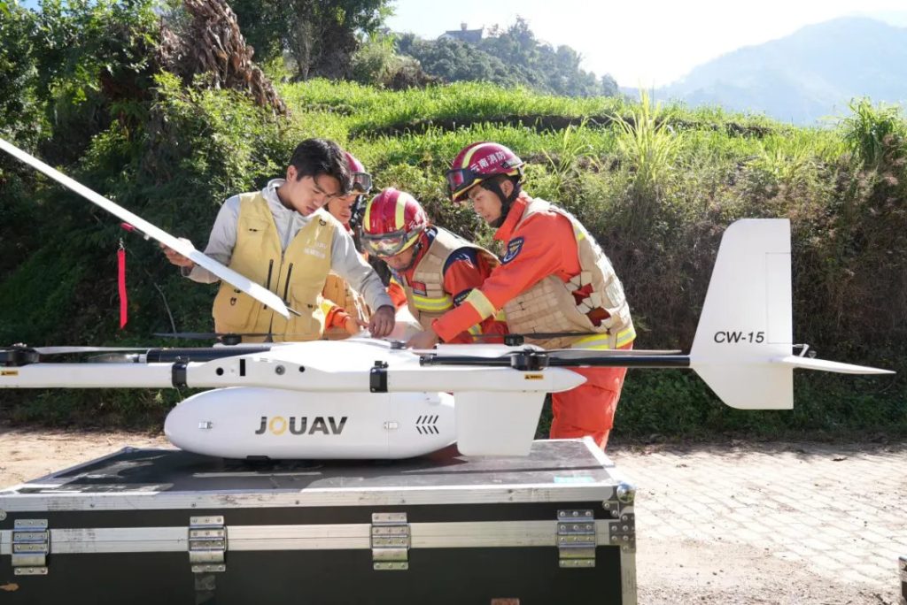
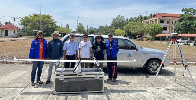
During this emergency communications test, JOUAV technicians collaborated closely with the Yunnan Fire and Rescue Team to train them on the proper installation and operation of the CW-15 VTOL UAV.
The Challenge
After natural disasters, power outages and network failures cause communication blackouts. This makes it hard for rescue teams to coordinate and gather vital information. In these situations, rescue operations need reliable communication and real-time data. This is especially true in remote areas.
To test drone technology, the Yunnan Fire and Rescue Team chose the remote, rugged Nujiang region. It has steep mountains, high altitudes, and poor communication. The goal was to test if drones could aid rescue efforts in these tough conditions.
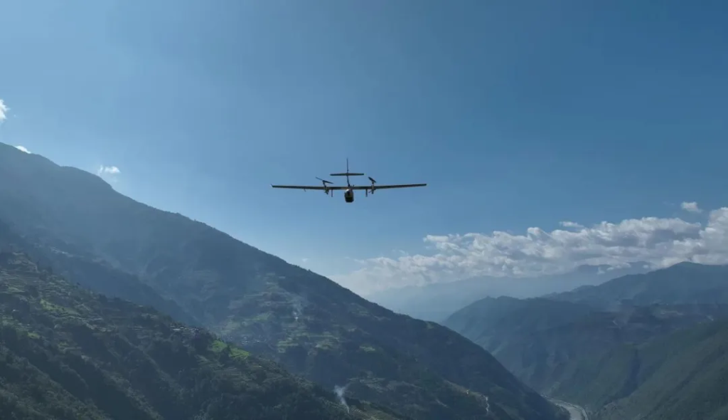
With its powerful vertical takeoff and landing (VTOL) capability and long flight endurance, JOUAV's CW-15 is ideally suited to traverse rugged mountainous terrain. It successfully established a stable aerial communication link, ensuring uninterrupted data flow across the disaster area.
Test Environment: Challenging Terrain
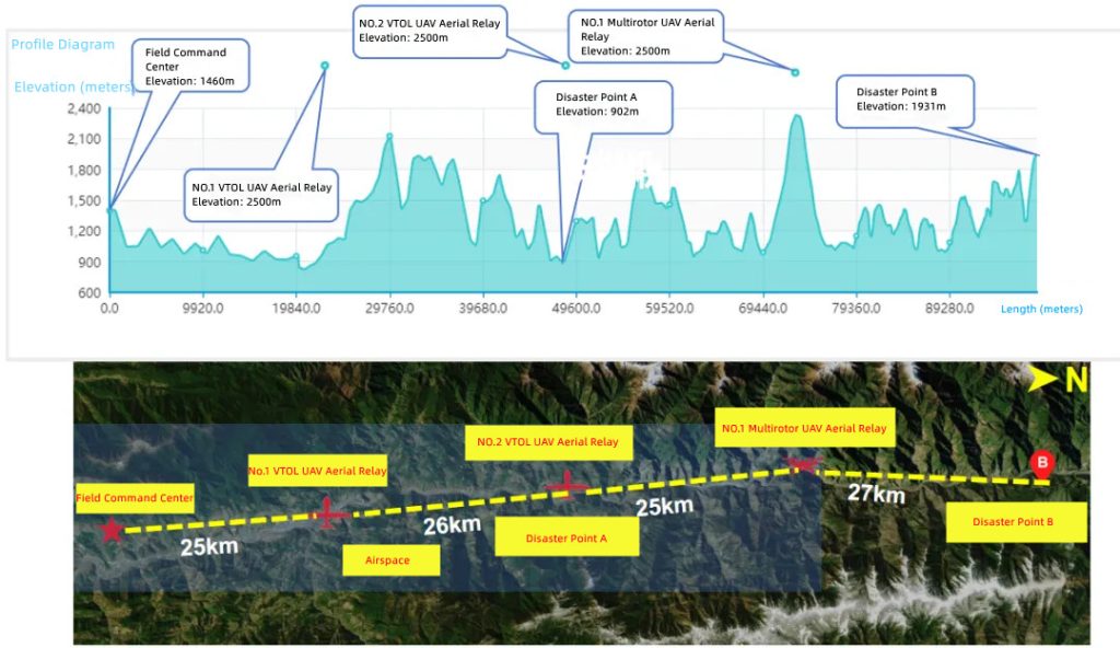
The test covered over 100 kilometers, from Luxi City to Fugong County. It navigated rugged terrain, from low villages to mountains over 3,300 meters high. The tough landscape made old ways to communicate and assess nearly impossible. So, we needed new solutions.
A comprehensive test environment was set up, including:
- A forward command post to oversee operations.
- Two simulated disaster sites representing real-life emergency scenarios.
- Multiple drone takeoff and landing zones, including fixed-wing drone, helicopter, and multi-rotor UAV points.
The two disaster points were Weila Village (Luxi City) and Ziziluo (Fugong County). They were chosen for their remote locations and difficult terrain.
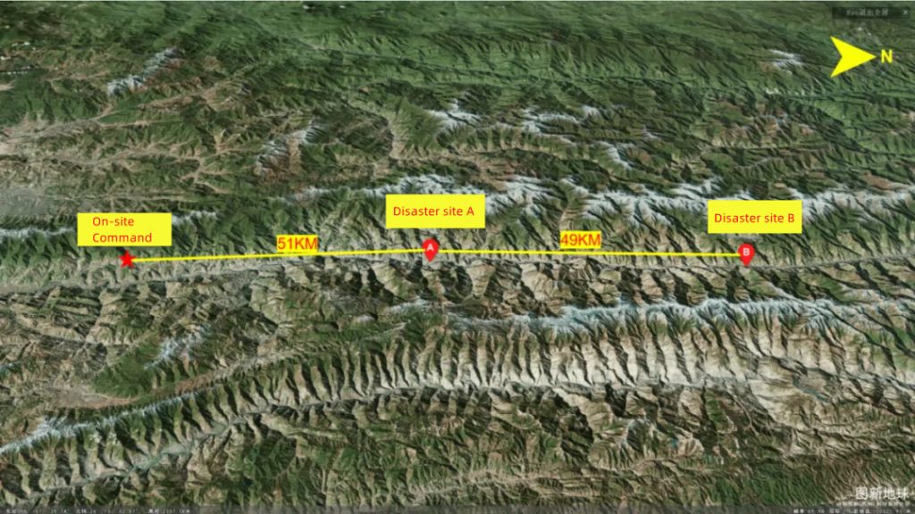
The test took place in Yunnan Province’s remote mountainous region, covering two disaster sites: Weila Village and Ziziluo Village.
Leveraging JOUAV’s VTOL and Multi-Rotor Drones
The test succeeded due to the combination of JOUAV’s VTOL drones (CW-15 and CW-25E) and multirotor drones.
- VTOL drones: The JOUAV's CW-15 and CW-25E VTOL drones have long flight times and can fly high. They helped set up airborne communication relays. By operating at higher altitudes, they linked isolated regions with the command post. This bridged communication gaps.
- Multi-rotor drones: These drones provided exceptional maneuverability and flexibility for local tasks, including aerial surveillance and establishing communication in confined spaces.
Together, the drones formed a network across the disaster zone. It overcame connectivity issues caused by the disaster. The drones had broadband self-organizing network modules. They ensured real-time transmission of images, videos, and data to the command center. The network covered an impressive 100 kilometers, providing continuous communication throughout the operation.
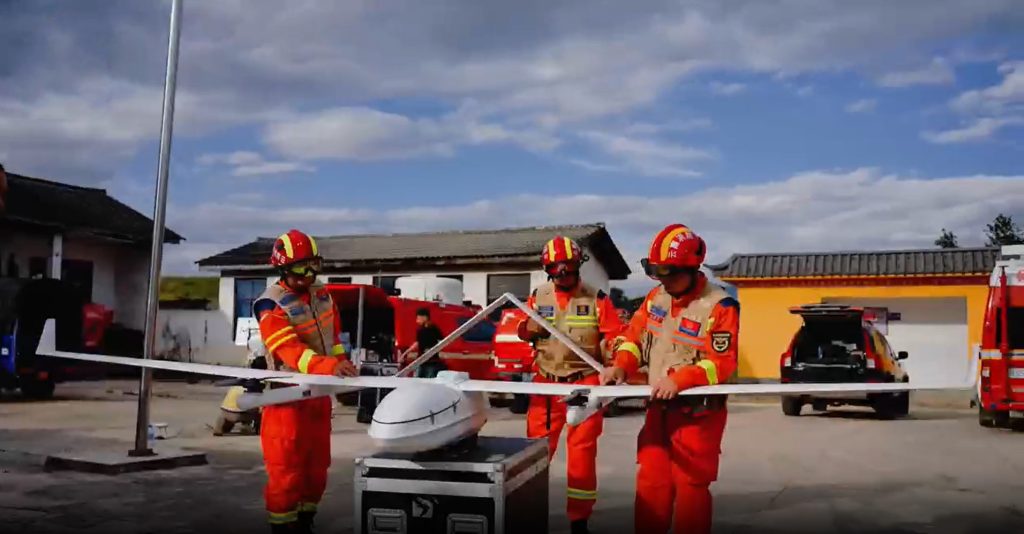
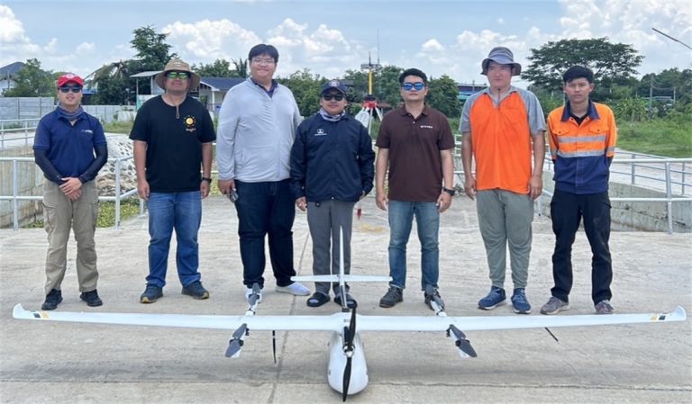
While installing and checking the CW-25E UAV's relay system, the Yunnan Fire and Rescue Team members meticulously verified each technical parameter to ensure the equipment would function reliably in such an extreme environment.
“"JOUAV's innovative drones helped us overcome communication issues. We provided accurate, timely info to our command center.”
— Wang Fei, Senior Engineer, Yunnan Fire and Rescue Team
To achieve comprehensive coverage across the disaster area, the team strategically deployed both VTOL UAVs and multi-rotor UAVs at key locations, ensuring optimal communication and surveillance capabilities.
Real-Time 3D Modeling for Disaster Management
One of the standout features of the JOUAV drones was their ability to generate real-time 3D models of the disaster area. In large-scale emergencies, affected zones are vast. So, traditional mapping methods are often slow and inefficient.
The team used the CW-15 drone to quickly capture high-res images and create 3D models of the disaster zones. The models gave a detailed, up-to-date view of the terrain. They helped the rescue team assess damage to roads, bridges, and buildings.
The team's 3D models provided a bird's-eye view of the disaster area. They helped identify and prioritize urgent rescue targets: trapped people and damaged infrastructure. The models helped planners find safe evacuation routes and good spots for medical camps.
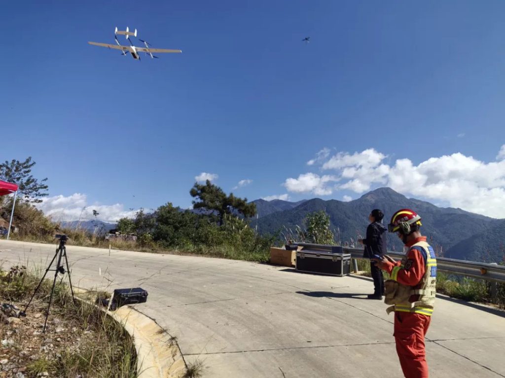
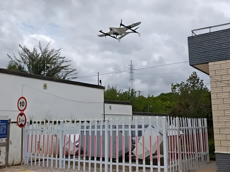
As part of the operation, Yunnan Fire and Rescue Team members launched the CW-15 UAV to collect real-time 3D modeling data for emergency command.
“The real-time 3D modeling capability of the CW-15 allowed us to assess damage and plan our rescue missions efficiently. We can now see the whole disaster area in real time. This greatly improved our ability to prioritize rescues and find where people were trapped.”
— Zhao Ping, Disaster Response Specialist, Yunnan Fire and Rescue Team
Conclusion
The success of the emergency communication test in the Nujiang region shows the power of JOUAV drones in disaster management. JOUAV's drones were key in helping the Yunnan Fire and Rescue Team respond to the disaster. They provided continuous communication links, real-time data, and accurate 3D models.
Using both fixed-wing and multi-rotor drones proved essential. They overcame the challenges of remote, tough terrain. The drones enabled perfect communication over vast areas. This lets rescue teams coordinate and make informed decisions, even in tough environments.


