Pengzhou’s rugged terrain, dense forests, and extreme weather conditions have long challenged ground-based threat detection and emergency response. Inaccessible areas and slow reaction times often ham
Guangxi Power Grid Company, in collaboration with JOUAV, has transformed transmission line maintenance in challenging terrains by implementing innovative drone-in-a-box inspection systems.
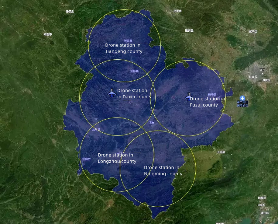
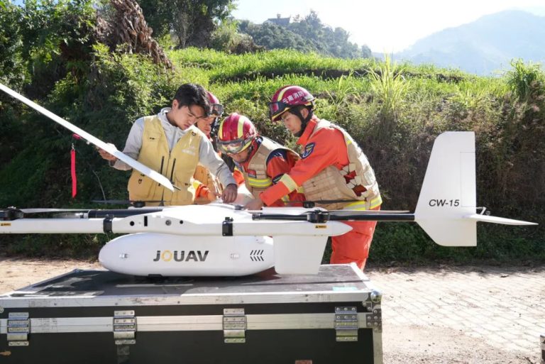
This solution utilizes the fully autonomous JOUAV VTOL Hangar system (JOS-C800 station + CW-15V drone) to address the inefficiencies and hazards of manual inspections in Chongzuo City—a region where 70% of the landscape comprises rugged mountains, karst formations, and dense valleys—while overcoming communication barriers in remote areas.
Challenges of Chongzuo Poweline Inspections
Prior to the drone system, inspection teams relied on manual methods: workers hiked for days to reach remote towers, often carrying heavy equipment like binoculars and infrared cameras.
During monsoon seasons, landslides would block access roads for weeks, delaying critical inspections. Night operations were nearly impossible due to lack of lighting, and cellular dead zones meant inspectors had to return to base to report findings, adding days to response times.
Strategic Deployment of Autonomous Systems
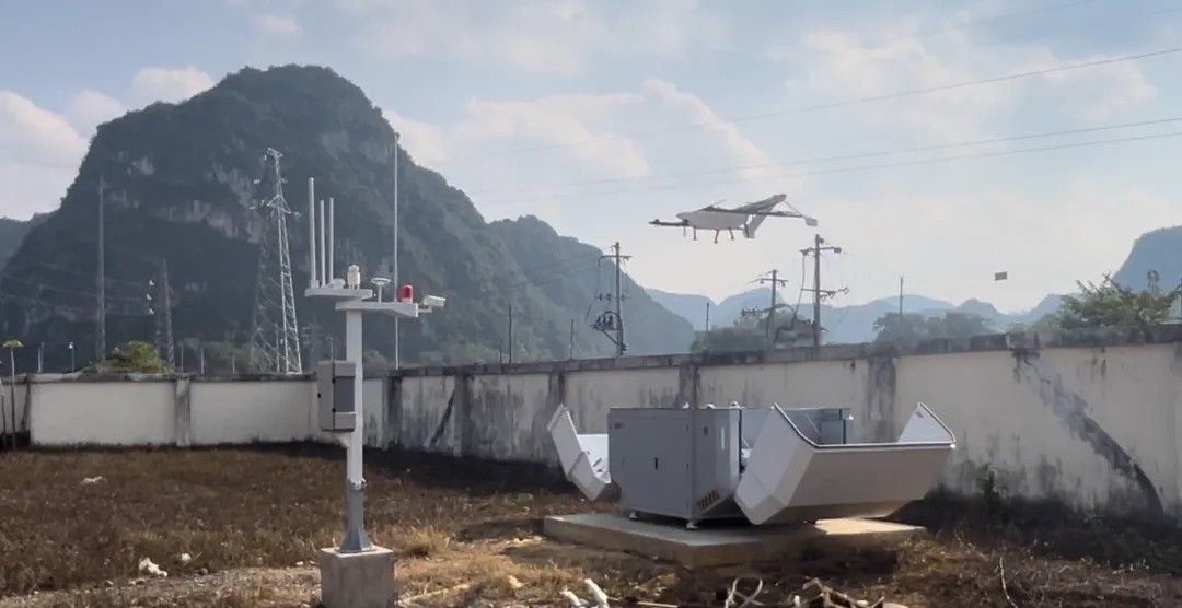
To address these challenges, five JOS-C800 docking stations were strategically positioned near substations and elevated ridgelines after a detailed analysis of grid density and terrain.
Engineered with IP54-rated enclosures and internal climate control, the hangars withstand Guangxi’s humid, rainy climate while maintaining optimal temperatures for drone electronics.
Each unit serves as a self-sustaining operational node, enabling 24/7 readiness with minimal human intervention. Maintenance teams conduct biannual checks to ensure system longevity.
VTOL Drones and Advanced Sensing for Precision Inspections
Two CW-15V VTOL drones per hangar execute automated missions, covering a 50-kilometer radius with 3-hour flight endurance. These drones “hop” between hangars, autonomously recharging to sustain continuous operations.
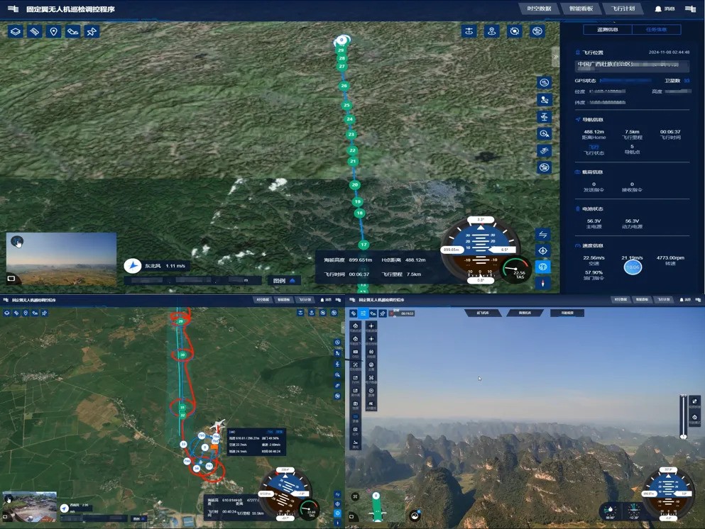
Equipped with dual sensing payloads—a 4K gimbaled camera and LiDAR—the drones perform daily powerline inspections along pre-programmed routes at 200–300 meters altitude.
The 4K camera streams real-time video to the command center, identifying issues like conductor discharge, tower tilts, or encroaching vegetation.
Simultaneously, LiDAR captures high-resolution point clouds to generate centimeter-accurate 3D models, enabling precise analysis of conductor sag, tower alignment, and vegetation clearance.
Emergency Response Enhanced by Mesh Networks
During emergencies such as landslides or line faults, traditional methods struggled to deliver timely data due to distance and signal limitations.
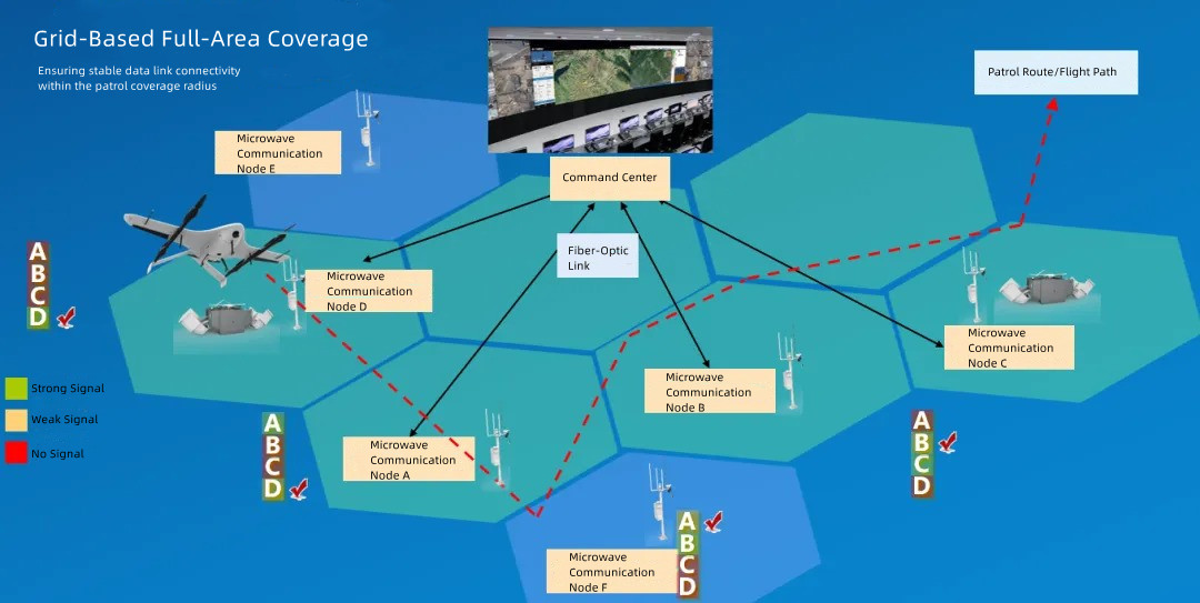
The JOS-C800 station integrates MESH radio self-organizing networks and microwave communication nodes to establish resilient, line-of-sight relay links.
Each hangar’s microwave equipment connects to neighboring nodes via directional antennas, creating a signal relay network backhauled to the command center through fiber-optic lines.
This setup ensures high-speed, stable data transmission even in areas devoid of cellular infrastructure.
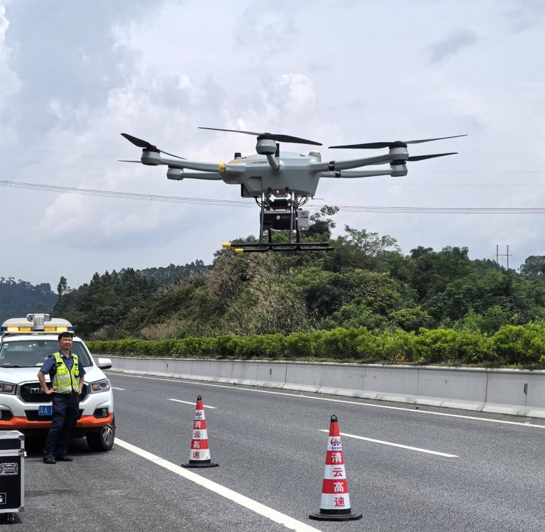
A notable example occurred during a landslide that severed a 220kV line in Tiandeng County. A CW-15V drone deployed from the nearest hangar reached the site in 12 minutes, bypassing a three-hour manual hike.
It streamed live 4K footage of the damage while LiDAR mapped the slide zone, producing a 3D model to calculate debris volume and prioritize excavation. This rapid response enabled crews to restore power 80% faster than previous protocols.
Conclusion
The system now covers 15,000 square kilometers (86% of Chongzuo City), slashing inspection cycles from weeks to hours and reducing manual labor. Since deployment, it has identified 132 high-priority defects that would have gone undetected by manual inspections, preventing potential outages.
In emergencies, the 4K video and LiDAR data have enabled damage assessments in just a few hours, compared to the previous several days.
More Use Cases
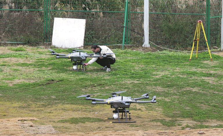
Zhaoqing, located in the western part of Guangdong Province, China, is known for its diverse topography and complex geological conditions. The region’s mountainous terrain, characterized by stee
Learn how JOUAV's CW-15 and CW-25E drones fixed communication issues during disasters.

JOUAV Product News and Use Cases
Fixed-Wing VTOL Drones Insights and Industry Trends
Invitations to online demo events