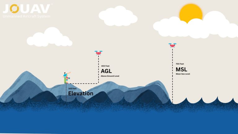
In aviation, precision isn’t just a goal—it’s a necessity. Every altitude reading, flight path, and safety protocol hinges on understanding two critical measurements: Mean Sea Level (MSL) and Above Gr
What Are Topographic Surveys?
Topographic surveys, or topo surveys, are specialized land surveys that create detailed three-dimensional maps of a property. These maps illustrate both natural and man-made features, including their location, size, height, and elevation changes.
Unlike other land surveys that focus on property boundaries or legal descriptions, topographic surveys provide a comprehensive view of the terrain, capturing the intricate details of the site's surface.
The primary purpose of a topographic survey is to aid in the design and planning phases of a project. Before any detailed design work commences, it is crucial to understand the physical characteristics of the land.
Topographic surveys offer insights into the best locations for features such as drainage systems and grading, as well as help define legal boundaries between properties to prevent disputes.
Conducted with precision instruments, topographic surveys produce highly accurate digital maps. The accuracy is measured by plottable error, which indicates the smallest distance that can be shown on a map at a specific scale.
For example, at a scale of 1:1000, a plottable error of 0.25 mm on the map translates to 250 mm (25 cm) on the ground. This level of detail ensures that the data is reliable for various applications, from urban planning to civil engineering and construction.
Types of Topographic Surveys
Topographic surveys encompass a range of methodologies, each tailored to specific needs and circumstances.
Here's a breakdown of some common types:
Geodetic Surveys
Geodetic surveys form the foundation for precise topographic mapping. They provide a framework of accurately determined points, often using global navigation satellite systems (GNSS) to establish precise coordinates.
These surveys are crucial for large-scale projects and applications requiring high levels of accuracy, such as infrastructure development and coastal mapping.
Plane Surveys
Plane surveys are conducted within a localized area, assuming a flat Earth surface for practical purposes. They are well-suited for projects where high accuracy is required but geodetic control points may be limited or unnecessary.
Plane surveys often employ traditional surveying techniques like theodolite and leveling to measure distances, angles, and elevations.
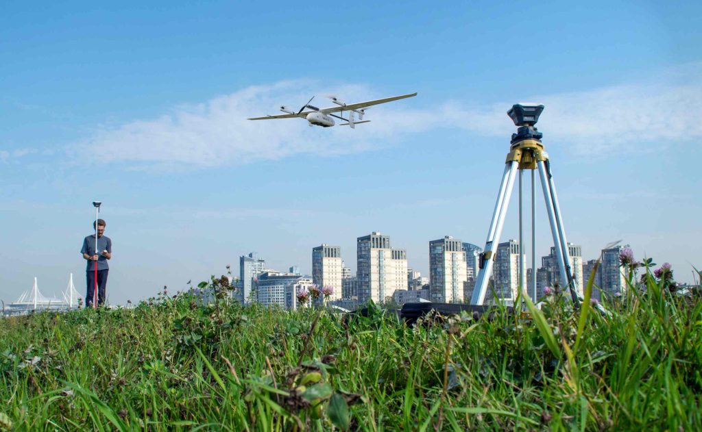
Airborne Surveys
Leveraging advanced technology, airborne surveys offer efficient and comprehensive data collection over large areas. Aerial photography, combined with techniques like LiDAR (Light Detection and Ranging), provides detailed three-dimensional information about the terrain.
Drones, airplanes, and even helicopters can be used for these surveys, making them suitable for projects ranging from urban planning to environmental monitoring.
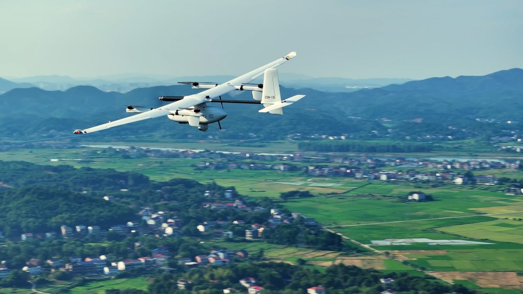
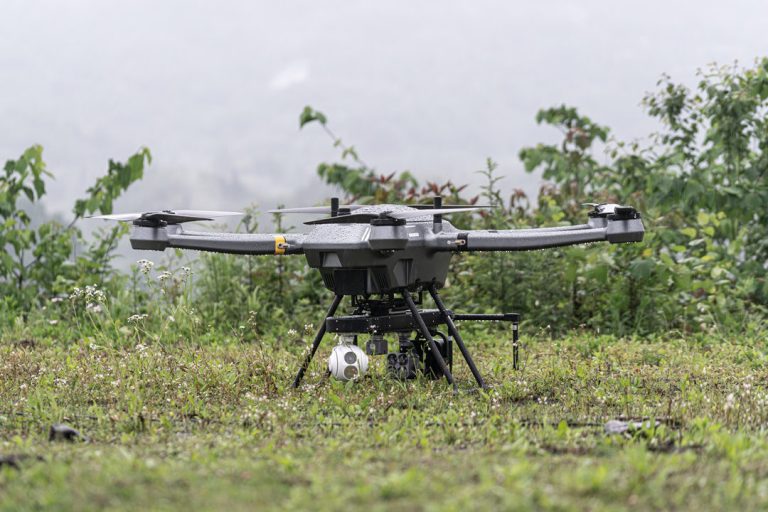
The JOUAV's CW-15 can capture detailed images of the terrain, providing valuable data for topographic mapping.
Construction Surveys
Construction surveys are a specialized type of topographic survey tailored to the needs of the construction industry. They provide precise measurements and data for various stages of construction, including site preparation, layout, and verification of structures.
These surveys ensure that buildings, roads, and other infrastructure are constructed according to design specifications and comply with local regulations.

Legal Boundary Surveys
Legal boundary surveys are conducted to determine and delineate property lines. They are essential for resolving property disputes, transferring ownership, and ensuring compliance with zoning regulations.
These surveys often involve reviewing historical records, conducting field measurements, and consulting with legal experts.
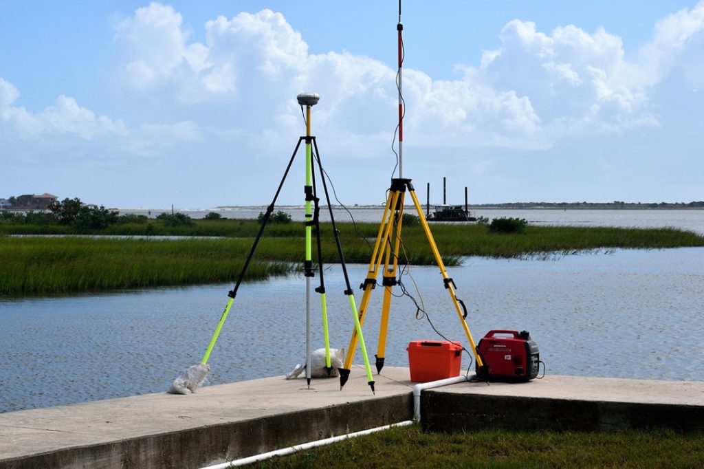
Hydrographic Surveys
While primarily associated with water bodies, hydrographic surveys can also be considered a subset of topographic surveys. They involve the measurement and mapping of underwater features, including depths, shoals, and obstacles. Hydrographic surveys are crucial for navigation, marine construction, and coastal management.
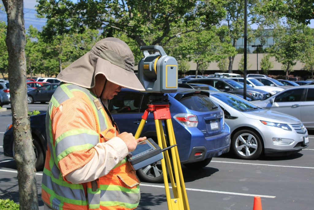
Equipment used in Topographic Survey
Topographic surveys require a sophisticated array of tools and equipment to accurately capture the physical characteristics of a land parcel.
- Total Station: A total station is a versatile surveying instrument that combines an electronic theodolite (for measuring angles) with an electronic distance meter (EDM). It measures distances and angles between points on the ground, allowing surveyors to determine elevations and create detailed topographic maps.
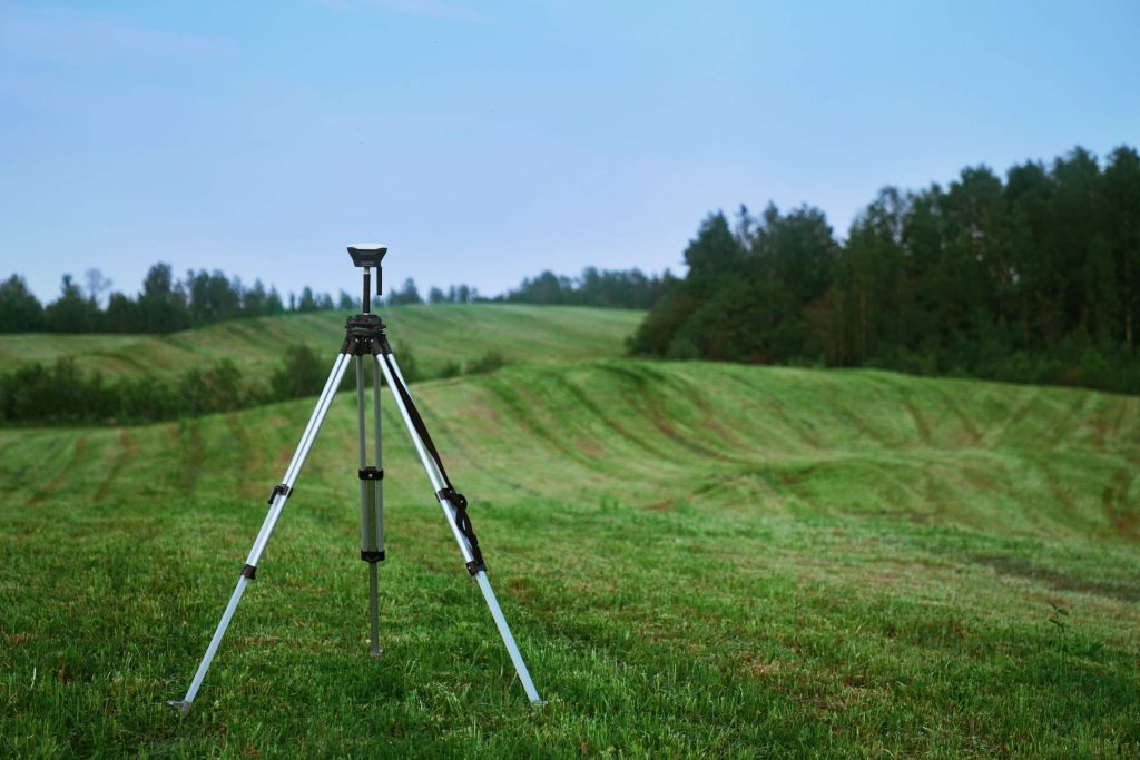
- GPS Receiver: Global Positioning System (GPS) receivers use satellite signals to determine their precise location on Earth. In topographic surveys, GPS receivers are used to locate points on the ground, establish control points, and verify the accuracy of other measurements.
- Laser Rangefinder: Laser rangefinders utilize a laser beam to measure the distance between the instrument and a target. They are particularly useful for measuring elevations, especially in challenging terrain or when high accuracy is required.
- Level: A level is a surveying instrument used to establish horizontal planes and determine elevations. It consists of a telescope mounted on a tripod, with a spirit level to ensure it is perfectly horizontal. Levels are essential for leveling surveys and setting up control points.
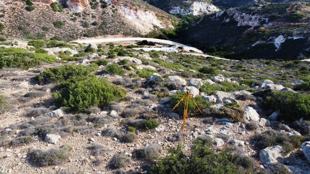
- Tripod: A tripod is a three-legged stand that provides a stable platform for surveying instruments. It is crucial for maintaining the stability and accuracy of measurements.
How Topographic Surveys Are Conducted?
Conducting a topographic survey involves several detailed and precise steps to ensure accurate mapping of the land's features.
Site Reconnaissance
During this first stage, known as site reconnaissance, surveyors assess the terrain, identify potential challenges, and decide on the best methods to use for the survey.
This early visit is crucial because it helps define what the survey needs to achieve—like how accurate the measurements need to be, what specific features will be mapped, and what type of data will be collected.
Data Collection
Once the site is understood, surveyors begin collecting data. They start by establishing control points with known coordinates, which act as reference markers for all other measurements.
These points can be set using GPS or traditional surveying methods. From these control points, surveyors measure distances and angles to create a network that covers the entire area being surveyed.
They also measure the elevation of various points relative to a known benchmark, ensuring accurate height data.
During this phase, surveyors also record the positions and elevations of specific features such as buildings, trees, and water bodies, gathering all the necessary information to accurately represent the terrain.
Data Processing
After data collection, the focus shifts to processing this information. Surveyors calculate the exact coordinates for each point based on the measurements taken, and they make adjustments to ensure the elevation data is consistent and accurate. Any anomalies or errors in the data are corrected to ensure the final results are reliable.
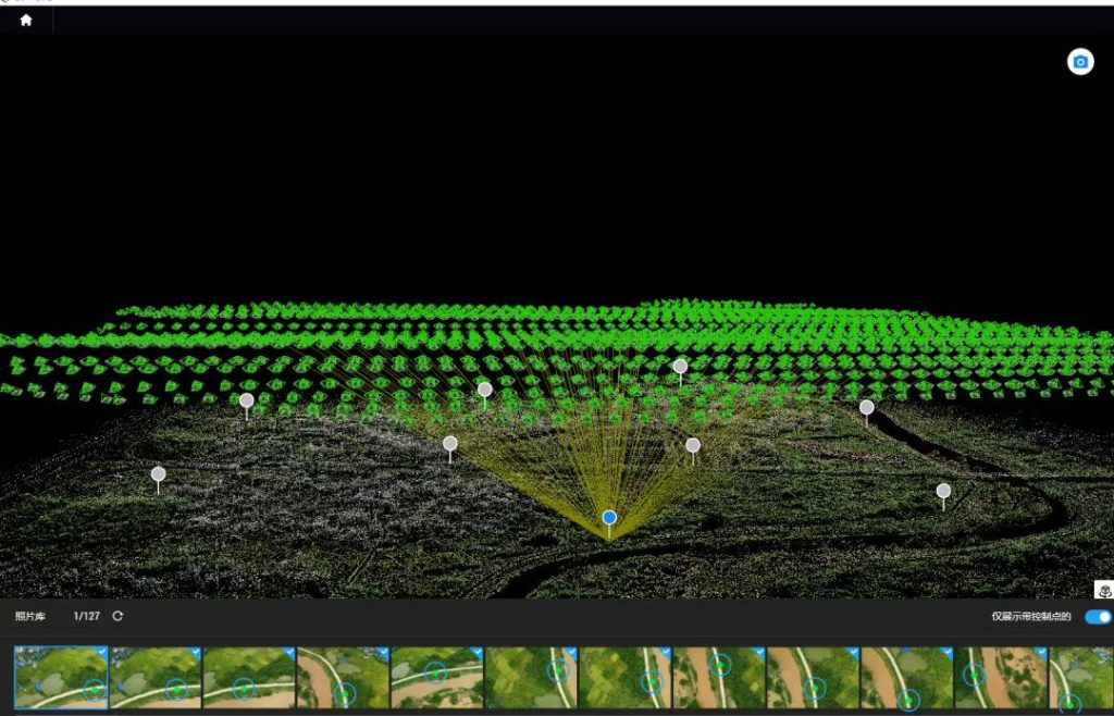
Map Creation
With the processed data, surveyors then create a topographic map. This map includes contour lines to show elevation changes and uses symbols to represent specific features, making the map easy to read and understand. The map is then carefully arranged to ensure it’s both informative and user-friendly.
Quality Control
Finally, quality control checks are performed to ensure the accuracy of the survey. Surveyors verify that all measurements are consistent and that the data aligns correctly. They also compare the survey results with existing maps or data to ensure everything is accurate.
This thorough process ensures that the topographic survey is a precise and dependable tool for planning and decision-making in various fields like construction, urban planning, and environmental management.
Common Challenges in Topographic Surveying
Topographic surveying faces several challenges that can impact its effectiveness and accuracy.
Outdated or Inaccurate Data
Historical records and previous measurements may be unreliable, leading to errors in boundary lines or terrain features. To address this, surveyors should use up-to-date GPS systems and aerial mapping technologies, and cross-check old records with new field surveys for accuracy.
Adverse Weather
Weather conditions also present significant hurdles. Adverse weather like heavy rain or extreme temperatures can affect visibility and measurement precision. Surveyors can mitigate these issues by scheduling surveys during favorable weather and using weather-resistant equipment, such as durable GPS devices or versatile drones.
Land Access and Permissions
Access to land for surveying can be restricted, requiring permission from property owners and navigating obstacles. Effective communication with landowners, explaining the survey’s purpose, and obtaining necessary permissions can ease access issues. Building good relationships with local authorities can also help.
Remote and Challenging Terrains
Surveying in remote or challenging terrains, such as steep slopes or dense forests, requires specialized equipment. Drones and advanced tools like laser scanners can provide accurate data in difficult-to-reach areas.
Time Constraints and Deadlines
Time constraints often pressure surveyors to complete tasks quickly. Efficient project planning, resource allocation, and the use of advanced surveying techniques can help meet deadlines and prevent delays. A well-organized team with expertise in these methods ensures timely and accurate results.
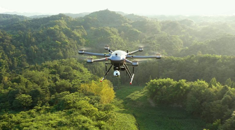
Additionally, utilizing advanced surveying technologies can significantly improve efficiency. For instance, drones like the JOUAV CW-15 offer rapid data collection capabilities with high-precision GNSS and LiDAR integration, making them ideal for large-scale mapping.
Best Drone for Topographic Surveys
Topographic surveys often take you to challenging places—whether it’s steep cliffs, dense forests, or rugged mountain terrain. To handle these conditions effectively, you need a drone that’s not just reliable but also versatile.
The CW-15 drone is designed with these needs in mind, offering a range of features that make it an excellent choice for topographic mapping.
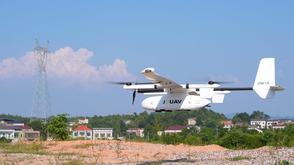
Easy Takeoff and Landing, Anywhere
One of the most significant advantages of the CW-15 is its ability to take off and land vertically (VTOL). Imagine being on a narrow mountain ridge or in a dense forest where space is limited. The CW-15 doesn’t need a runway; it can launch straight up from confined spaces, making it ideal for remote and rugged areas where traditional drones would struggle. Additionally, this drone can even take off from moving vehicles or ships, providing flexibility for missions that require mobility and adaptability.
Extended Flight Time and Coverage
Efficient coverage is key in topographic surveys. The CW-15, with its 180-minute flight time and 61 km/h cruising speed, can survey up to 1,200 hectares (12 square kilometers) in a single mission at a GSD of 3 cm/px. Its 50-kilometer flight range further enhances its ability to cover large areas without frequent ground station repositioning, streamlining the survey process and saving time and resources.
Precision Mapping with RTK and PPK
Accuracy is everything in topographic surveys. The CW-15 is equipped with Real-Time Kinematic (RTK) and Post-Processing Kinematic (PPK) technologies, both of which are crucial for achieving the high precision needed in mapping. These systems reduce the need for ground control points, allowing you to produce accurate maps with less setup time. Whether you’re working on a construction project or environmental assessment, this level of accuracy ensures your data is reliable.
Flexible Payload Options
One of the standout features of the CW-15 is its ability to carry a variety of sensors. With a payload capacity of 3 kg, you can equip the drone with an RGB camera, oblique camera, LiDAR sensor, or even a multispectral camera, depending on the needs of your project. This flexibility allows you to tailor the drone to different types of surveys, whether you need detailed photogrammetry or comprehensive LiDAR scanning.
Adapting to Challenging Environments
Operating in tough environments means dealing with obstacles and varying terrain. The CW-15 is equipped with millimeter-wave radar that detects obstacles both below and ahead, helping the drone automatically avoid hazards like trees, buildings, and even other drones with ADS-B modules. This system not only keeps the drone safe but also ensures that it can adapt to different terrains, reducing the chances of risky landings.
Read More
So, you’re wondering if you can fly your drone in the rain. The answer is generally a resounding NO. Most drones—especially consumer models like the DJI Mini or Air series—aren’t waterproof.
Rai
With their six-propeller design, hexacopters stand out for their stability, payload capacity, and flight redundancy. This makes them a powerful choice for aerial photography, precision agriculture, in

JOUAV Product News and Use Cases
Fixed-Wing VTOL Drones Insights and Industry Trends
Invitations to online demo events