So, can you fly a drone over people in 2026?
Short answer: yes—but don’t expect a free pass. Over the past few years, regulators like the FAA and EASA have fundamentally changed the game. They&#
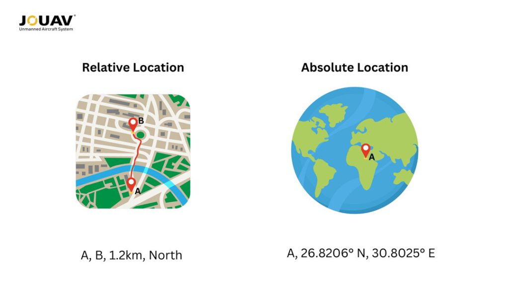
What is Relative Location?
Relative location refers to the position of a place in relation to other landmarks, regions, or geographical features.
It focuses on how a location interacts with its surroundings, emphasizing context and spatial relationships rather than specific coordinates.
This approach allows for a more intuitive understanding of geography, helping individuals grasp how places relate to one another and navigate their environments effectively.
How to Find Exact Location by Using Longitude and Latitude?
To understand absolute location, it is important to grasp the concepts of latitude and longitude.
Latitude measures how far north or south a location is from the Equator, which is designated as 0° latitude. Lines of latitude, known as parallels, run horizontally around the globe.
These values range from 0° at the Equator to 90° at the poles. Each degree of latitude corresponds to approximately 69 miles (111 kilometers) on the Earth's surface, providing a relatively consistent measurement. For example, New York City is located at about 40° N.
Longitude, on the other hand, measures how far east or west a location is from the Prime Meridian, an imaginary line running from the North Pole to the South Pole through Greenwich, England.
Longitude values extend from 0° to 180° east and west. Unlike latitude, the distance between lines of longitude varies because the Earth is spherical; they converge at the poles. For instance, New York City has an absolute longitude of about 74° W.
To determine an exact position on Earth, both latitude and longitude must be used together. This pairing creates a unique coordinate that specifies a location with precision.
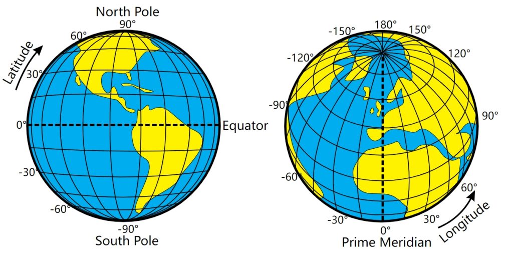
Latitude and Longitude of the Earth. Image source from commons.wikimedia.org
Precision
To determine absolute location, tools like GPS devices, maps, and compasses are used.
These rely on geographic coordinates to provide accurate positioning, essential for navigation in aviation, maritime travel, and daily driving.
Relative location is often identified through observation and local knowledge.
A person might say a restaurant is “two blocks north of the park,” relying on familiar landmarks instead of exact coordinates.
Tools
To determine absolute location, tools like GPS devices, maps, and compasses are used.
These rely on geographic coordinates to provide accurate positioning, essential for navigation in aviation, maritime travel, and daily driving.
Relative location is often identified through observation and local knowledge.
A person might say a restaurant is “two blocks north of the park,” relying on familiar landmarks instead of exact coordinates.
Dependence
Absolute location is independent of surrounding locations; it remains constant regardless of perspective.
This makes it particularly valuable in sparsely populated or rural areas where recognizable landmarks may be few.
The stability of absolute location enables consistent mapping and navigation.
Conversely, relative location depends on a chosen reference point.
The same place can have multiple relative locations based on different landmarks or contexts.
For example, a hotel might be described as “across from the museum” or “next to the grocery store,” both providing distinct frames of reference.
Usages
Absolute location is crucial when exact coordinates are required, such as in scientific research or GPS navigation.
It is vital for the functioning of automated transportation systems, delivery services, and various technological applications.
The accuracy of absolute location data underpins many modern conveniences and scientific endeavors.
Relative location is often used in everyday conversations, such as when giving directions or describing a place based on recognizable features.
Telling someone that “the coffee shop is next to the bookstore” utilizes relative positioning, making it intuitive for daily navigation.
This concept is also employed in geography to analyze spatial patterns and relationships, influencing areas like logistics and emergency response.
Read More
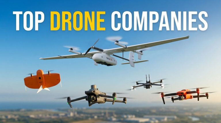
The drone industry isn’t just growing; it’s fundamentally reshaping how we work. According to recent data from Precedence Research, the global commercial drone market is set to hit $44.5 b
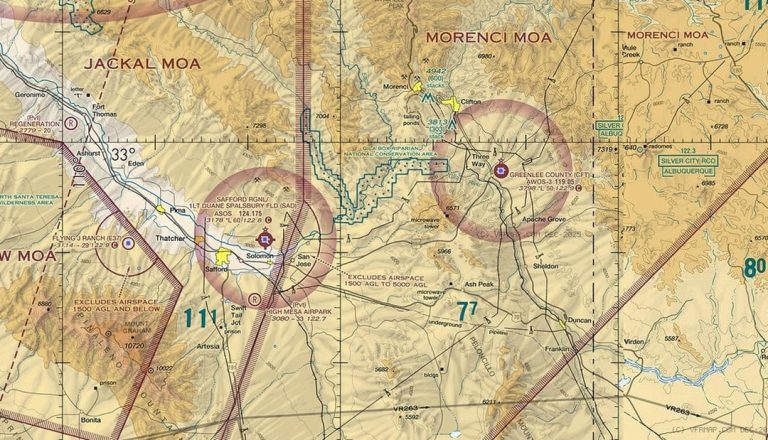
Class E airspace is everywhere, but it’s rarely obvious. It can start at the surface, at 700 feet, or at 1,200 feet—and if you’re a drone pilot, that difference changes everything.
So how do you read

JOUAV Product News and Use Cases
Fixed-Wing VTOL Drones Insights and Industry Trends
Invitations to online demo events