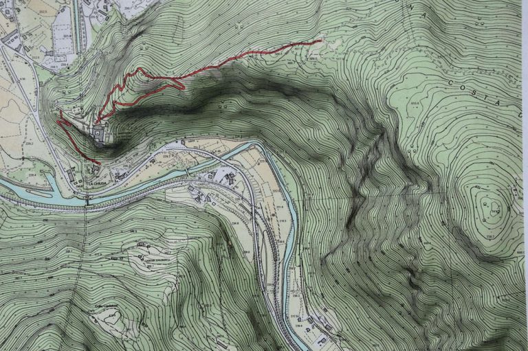
Comprehensive Guide to Boundary Surveys
Are you a property owner unsure of where your exact property lines are? Or maybe you're planning a construction project or dealing with a boundary dispute with a neighbor?
Boundary surveys are the key to getting the clarity you need. They provide precise measurements of your land, ensuring you know exactly where your property begins and ends, which is crucial for legal security and future development.
In this detailed guide, we’ll walk you through the different types of boundary surveys, how they work, and why they matter.
What is a Boundary Survey?
A boundary survey, often called a cadastral or property survey, is a type of land survey that determines and marks the precise location of property lines, corners, and boundaries. The main purpose of a boundary survey is to establish or confirm the legal boundaries of a property, ensuring that the rights of landowners are protected.
Licensed land surveyors conduct these surveys using a combination of historical records, legal documents, and modern measurement techniques. This thorough process helps avoid disputes and encroachments by clearly defining where one property ends and another begins.
Boundary surveys are essential for anyone involved in buying, building on, or managing land. They provide clarity and peace of mind, allowing property owners to navigate their rights and responsibilities confidently. Whether you're purchasing a new property or planning a construction project, a boundary survey is a critical step in ensuring that your investment is secure and well-defined.
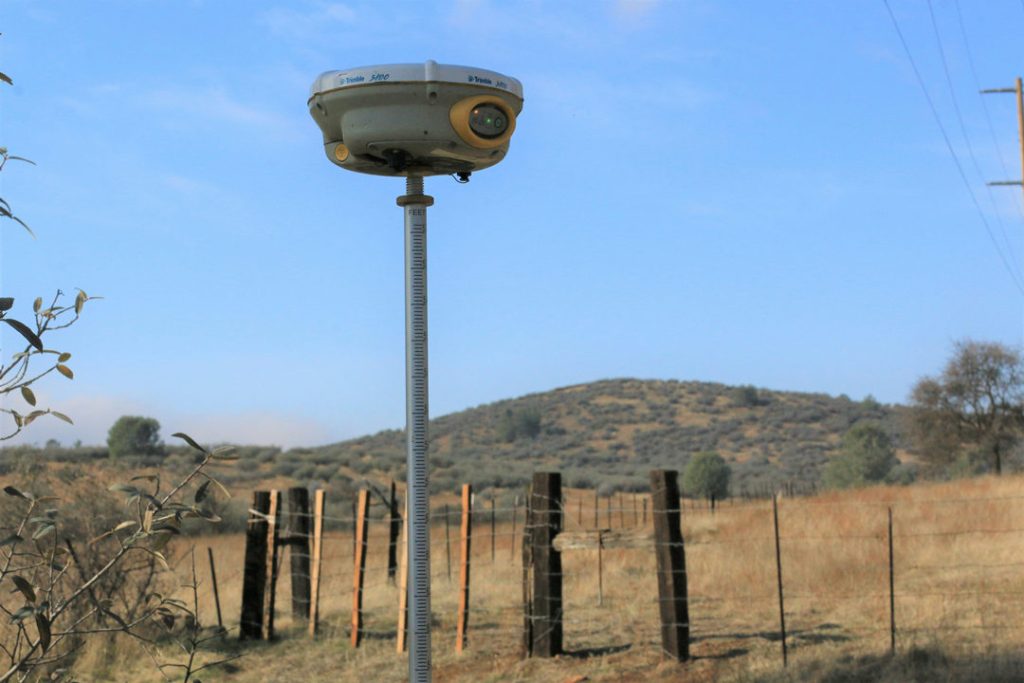
When Do You Need a Boundary Survey?
- Buying or Selling Property: If you’re purchasing a new property, a boundary survey can clarify the exact boundaries and prevent future disputes with neighbors. Sellers can also benefit from having a survey on hand to assure potential buyers of the property’s limits.
- Building or Renovating: Before starting any construction or major renovations, a boundary survey is crucial to ensure that new structures are built within your property lines. This can help you avoid costly mistakes, such as building a fence or extension that encroaches on a neighbor's land.
- Subdividing Land: If you plan to divide a parcel of land into smaller lots, a boundary survey is necessary to establish clear property lines for each new lot. This is essential for complying with local zoning regulations and ensuring that each property is legally defined.
- Resolving Disputes: If you have a disagreement with a neighbor over property lines—such as a fence placement or an encroachment—a boundary survey can provide a definitive resolution. The survey can clarify the exact boundaries and help avoid legal disputes.
- Easements and Rights of Way: If there are easements or rights of way affecting your property, a boundary survey can identify these areas and clarify how they impact your land. This is particularly important for properties with utility lines or access roads crossing them.
- Financing Requirements: Some mortgage lenders and title companies require a boundary survey before approving financing for a property. This ensures that the property’s boundaries are well-defined and legally secure.
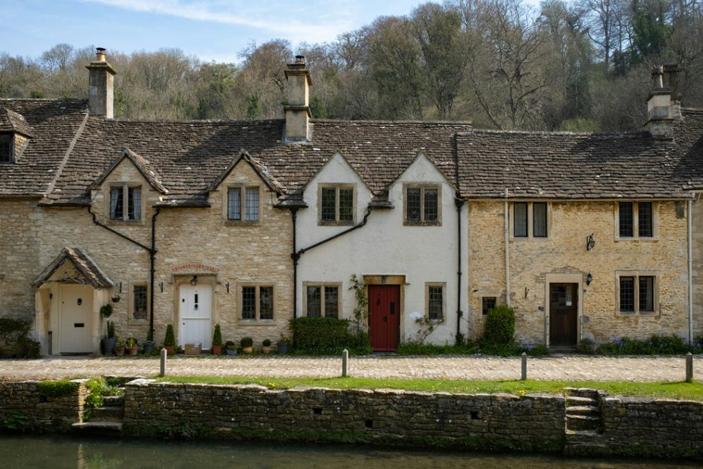
The Boundary Survey Process
The boundary survey process involves several key stages, each contributing to accurately determining and marking a property’s legal boundaries.
- Research: The process begins with extensive research into the property’s historical records. A surveyor will consult documents at the Registry of Deeds and other relevant sources, such as probate records, county commissioners' offices, and municipal offices. This research may also involve reviewing older surveys, historical maps, and information from adjoining landowners. The goal is to gather as much information as possible about the property's legal description, easements, and previous surveys.
- Deed Sketch and Planning: Based on the research, the surveyor prepares a deed sketch or worksheet. This involves identifying key record calls along each boundary line and determining how the property’s current description aligns with historical data. This step is crucial, as it helps reconcile discrepancies between old and new property descriptions and establishes a clear plan for fieldwork.
- Fieldwork and Data Collection: The largest component of the boundary survey is the field reconnaissance. During this stage, the surveyor visits the property to locate existing boundary markers (monuments) and measure the land using modern surveying equipment. Fieldwork often includes establishing a control network, known as a traverse, which helps identify property corners and boundaries. This phase also involves marking the boundaries on the ground.
- Data Entry and Analysis: After the fieldwork, the surveyor analyzes the collected data. This includes calculating acreage, verifying corner locations, and identifying any encroachments or easements. The accuracy of the measurements is thoroughly reviewed to ensure the property’s boundaries are correctly defined. This analysis integrates both historical research and field data.
- Final Plan Preparation: Once the data has been reviewed and validated, the surveyor creates a final boundary survey plan. This plan includes the results of the survey, such as the marked property lines, any identified monuments, and a legal description of the boundaries. The plan is a formal document, typically prepared in compliance with state licensure standards, allowing other land surveyors to verify the findings if needed.
- Marking Boundaries and Reporting: The final step involves marking the property boundaries with permanent monuments like iron pins, concrete markers, or wooden stakes. The surveyor then provides a report explaining the survey’s conclusions and justifications for the boundary determinations. This report, along with the survey plan, serves as a legal record of the property’s boundaries.

How Much Does a Boundary Survey Cost?
The cost of a boundary survey can vary significantly depending on the survey’s complexity, the property’s characteristics, and local surveyor fees.
For a straightforward boundary survey on a smaller property, costs generally range between $100 and $600, especially if property records are clear and the terrain is accessible.
However, for larger or more complex projects—such as new home construction or irregularly shaped properties—costs can go up to $2,000 or more.
Here are the key factors that can impact the cost of a boundary survey:
- Property Size: Larger properties require more time to survey, resulting in higher costs.
- Terrain and Accessibility: Challenging landscapes, like dense forests or steep hills, may require additional equipment and time, increasing costs. Properties in remote areas might also involve extra travel expenses.
- Complexity of Boundaries: Properties with unusual shapes, multiple boundary lines, or complex legal histories require more research and fieldwork, which can raise costs.
- Quality of Records: If records are incomplete or conflicting, surveyors may need additional time for research and reconciliation, leading to higher fees.
- Local Regulations and Standards: Local rules on survey standards or required markings can also add to the expense.
- Professional Fees: Rates for surveyors vary by location and experience, so it’s a good idea to get quotes from multiple providers.
Why Choose Drones for Boundary Surveys?
Traditional surveying requires surveyors to physically access all areas, which can be time-consuming and challenging, especially in rugged or heavily vegetated terrain. Reaching remote or hazardous areas also presents safety risks and may result in incomplete data.
Additionally, these methods are labor-intensive and costly, with long setup times, manual measurements, and extensive post-processing.
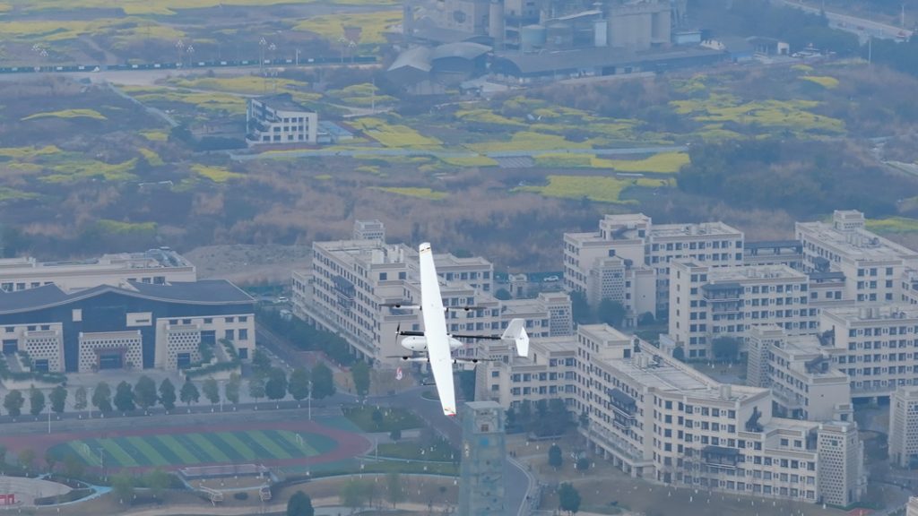
Higher Efficiency
Drones can cover large properties at a rate that’s challenging to match with traditional surveying techniques. A survey that would typically take a crew a full day—or even several days in difficult terrain—can often be completed by a drone in just a few hours.
For example, the JOUAV CW-15 drone, equipped with the CA-103 aerial camera, achieves a ground sample distance (GSD) of 4 cm at an altitude of 373 meters, covering up to 1,380 ha (13.8 km²) in a single flight.
This is possible thanks to GNSS (Global Navigation Satellite Systems) and RTK (Real-Time Kinematic) positioning systems on modern drones, which enable precise data collection.
The ability to finish surveys faster not only shortens project timelines but also reduces labor costs and lets surveyors move efficiently from one project to the next.
Safer Access to Hazardous Areas
Drones can safely survey hazardous areas that may be risky or inaccessible for surveyors to reach on foot. For instance, in areas with steep terrain, rocky outcrops, or dense forests, manually accessing property boundaries can be dangerous and time-consuming.
Drones remove the need for physical entry into these zones, capturing data remotely. By keeping surveyors out of risky areas, drone surveys reduce the potential for accidents and improve safety for survey teams.
Drone technology is especially valuable for surveying properties near cliffs, wetlands, or industrial sites where physical obstacles make traditional surveying challenging and potentially unsafe.
Cost-Effectiveness
Using drones for boundary surveys can often be more economical than traditional methods, especially for large or complicated sites.
While traditional surveys require multiple team members, extensive equipment, and more field time, drones streamline the process, typically requiring fewer personnel and less time in the field.
The minimized time on-site and reduced need for extensive equipment help cut down on overall survey costs.
Additionally, with fewer resources needed to complete each survey, drone surveys can reduce operational expenses while still delivering high-quality results.
For property owners, this can mean lower surveying costs without sacrificing accuracy or detail.
Enhanced Data Visualization
One of the standout advantages of drone surveys is the quality and richness of data collected. High-resolution images (up to 61 MP or more) captured by drones enable surveyors to create accurate 2D orthomosaic maps and 3D models that are detailed down to the centimeter.
LiDAR-equipped drones can even create digital elevation models (DEMs) and digital terrain models (DTMs), which are crucial for properties with complex topography.
A LiDAR drone, such as the CW-15 equipped with the Jolidar-120, can capture elevation data with an accuracy of ±2 cm. This level of precision allows for detailed visualization of boundaries, slopes, and nearby structures.
Enhanced visualization not only makes it easier for property owners to understand their boundaries but also aids in legal and planning applications, where precise 3D models can illustrate property lines, easements, and potential encroachments with exceptional clarity.
FAQ
Are Boundary Surveys Public Record?
Boundary surveys themselves aren’t typically part of public records, but documents connected to these surveys, like deeds, title documents, and recorded plats or maps, often are. These can generally be accessed through local government offices, such as the county recorder or registry of deeds.
In some regions, surveyors may be required to file a copy of the boundary survey map or plat with the local office once completed, making it accessible to the public. Requirements for filing boundary surveys vary by jurisdiction, so the availability of these documents can differ. Accessing public land records may involve fees, forms, or visiting the government office in person or online.
To locate boundary information, start by checking your local government’s land records. If available records are incomplete or outdated, you may want to consult a professional surveyor to clarify or update the survey information.
How Long Does a Boundary Survey Take?
The time required to complete a boundary survey usually ranges from two to ten business days, depending on the property's size, location, and the surveyor's availability.
In cases where timing is critical, many surveyors offer expedited services that can reduce the timeframe to two to five days for an additional fee.
Availability and the specific complexities of the property may also affect the timeline, so it’s best to consult your surveyor about expected scheduling.
Do I Need a Boundary Survey to Build a Fence?
Yes, you need a boundary survey to build a fence. Here are key reasons why:
- Accurate Property Lines: A boundary survey clarifies your property lines, preventing you from accidentally encroaching on your neighbor's land. If you build a fence too close to the boundary, it may lead to disputes if new neighbors discover the encroachment.
- Legal Protection: Knowing your exact property lines protects you from potential legal issues. If a neighbor later discovers your fence is on their property, you could face demands to remove it.
- Smooth Transactions: If you decide to sell your home, buyers may require a survey. If your fence is incorrectly placed, it could complicate the sale and require costly adjustments to comply with zoning laws.
How Accurate is Boundary Survey?
The accuracy of boundary surveys can vary significantly by state. For example, in Washington, the maximum allowable relative accuracy for boundary surveys is 0.07 feet plus 200 parts per million.
In areas with higher property values, greater accuracy is typically expected. It's essential to consult local regulations and standards, as they can dictate the precision required for your specific boundary survey.
How Often Should a Boundary Survey Be Conducted?
The ideal frequency for boundary surveys can vary based on individual circumstances. However, as a general guideline, re-surveying your property every 5 to 7 years is often recommended to ensure the accuracy of your property lines and address any potential changes.
Consider scheduling a new boundary survey if:
- You're making significant property modifications: Renovations, additions, or structural changes can impact property lines.
- Buying or selling a property: A recent survey provides valuable information for both buyers and sellers.
- Subdividing your land: Surveys are crucial for creating accurate property divisions.
- Making financing decisions: Lenders may require updated surveys for mortgage purposes.
- Resolving property disputes: A survey can provide evidence to support your claims.
- You lack a current survey: If you don't have a recent survey, it's advisable to obtain one to establish accurate property boundaries.
Who Does Boundary Surveys?
Boundary surveys are typically conducted by professional land surveyors. These individuals have specialized training and expertise in measuring and mapping property lines. They use advanced equipment, such as GPS (Global Positioning System) and total stations, to accurately determine and record property boundaries.
Who Pays for a Boundary Survey?
Typically, the party initiating the boundary survey is responsible for paying the costs. This could be:
- Property Buyer: When purchasing a property, the buyer may be responsible for paying for a boundary survey as part of due diligence.
- Property Seller: In some cases, the seller may agree to pay for a boundary survey as an incentive to attract buyers.
- Lender: Mortgage lenders may require a boundary survey before approving a loan, and they may cover the costs themselves or pass them on to the borrower.
- Developer: Developers often pay for boundary surveys when planning new construction projects or subdivisions.
- Legal Parties: In cases of property disputes, the parties involved may agree to share the costs of a boundary survey.
What is the Difference Between a Boundary Survey and an Alta Survey?
A boundary survey is specifically designed to determine the exact boundaries of a property, focusing on identifying and marking property corners and lines based on legal descriptions in deeds and historical records.
Its main goal is to establish ownership lines and resolve disputes regarding property boundaries. In contrast, an ALTA (American Land Title Association) survey includes all the elements of a boundary survey but adds more detailed information.
ALTA surveys provide comprehensive insights into the property, including easements, rights-of-way, zoning classifications, and potential encroachments. They are typically required for commercial properties and adhere to specific standards set by ALTA and the National Society of Professional Surveyors (NSPS).
Overall, while a boundary survey addresses property lines, an ALTA survey offers a deeper, more extensive overview of the property.
What is the Difference Between a Land Survey and a Boundary Survey?
A land survey is a broad term that encompasses various types of surveys to determine the location and dimensions of land, which can include topographic surveys, hydrographic surveys, construction surveys, and boundary surveys.
Land surveys assess property lines, natural features, and improvements on the land for diverse purposes, such as land use assessments and development planning.
In contrast, a boundary survey is a specific type of land survey focused solely on determining the exact boundaries of a parcel.
What is the Difference Between a Boundary Survey and a Topographic Survey?
While a boundary survey aims to identify and establish property lines, a topographic survey provides detailed information about the land's contours and features. A boundary survey focuses on legal boundaries and ownership issues, identifying property corners and lines.
On the other hand, a topographic survey measures elevation and configuration, capturing aspects like hills, valleys, water bodies, and vegetation. This survey generates a topographic map that illustrates these physical characteristics in relation to property boundaries.
Topographic surveys are particularly valuable for land development projects, helping engineers and architects understand how the land's features will impact construction, drainage, and landscaping. In essence, boundary surveys deal with ownership, whereas topographic surveys explore the land's physical layout.


