The impact of drones in construction has already transformed the efficiency and accuracy of the industry. However, the list of benefits can be extensive, and here are the main benefits that drones have brought to construction and civil engineering companies.


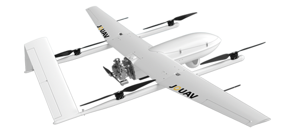
High-Performance Drones
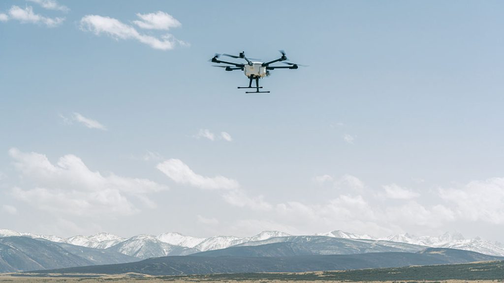
Designed specifically for construction purposes, our drones offer extended flight times, unrivaled stability, effortless operation, and a remarkable payload capacity. Equipped with advanced GPS technology and obstacle avoidance sensors, our drones ensure safe and efficient flights, empowering you to excel in any construction project.
Real-Time Data Acquisition and Processing
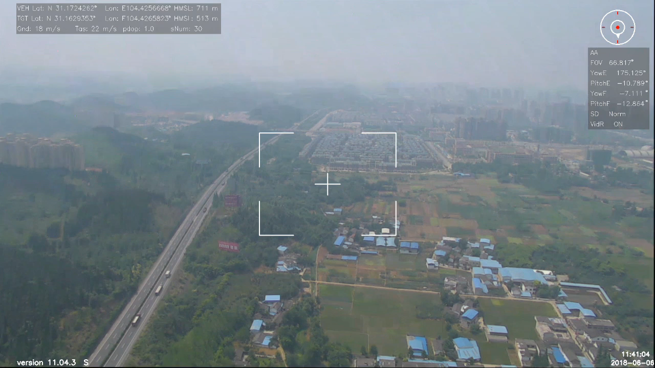
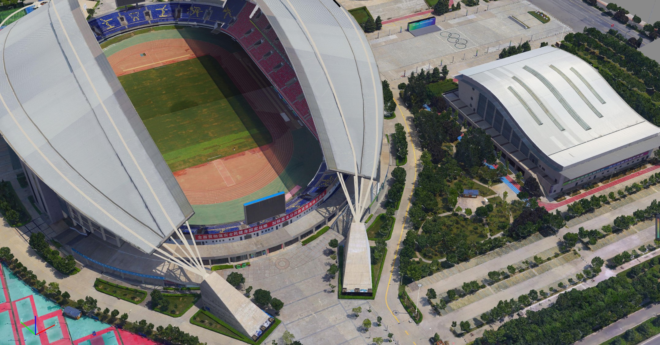
JOUAV drones capture high-resolution aerial images, videos, and accurate measurements in real-time, providing you with immediate insights into project progress, site conditions, and potential issues. Stay ahead of the curve with real-time data, enabling proactive decision-making and timely problem-solving to keep your construction projects on track.
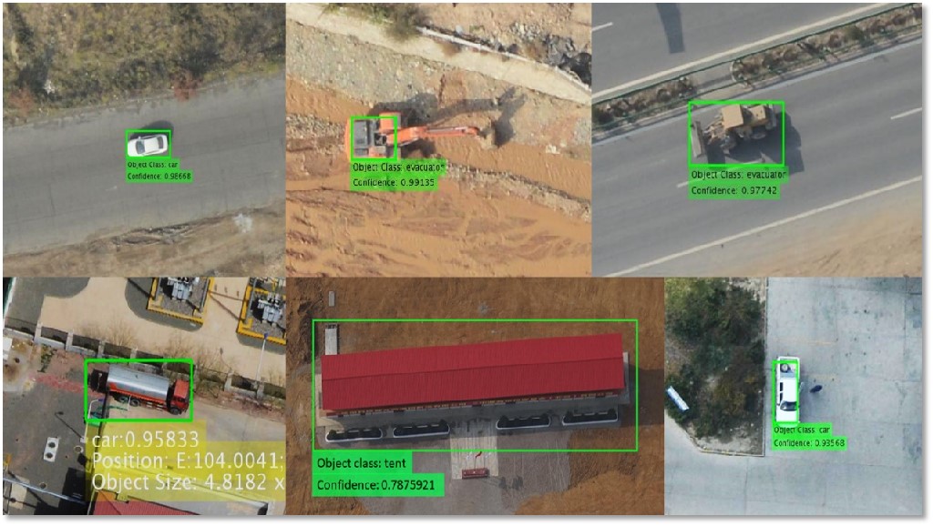
AI Integration for Unparalleled Efficiency
Our drones go beyond mere data collection. By integrating artificial intelligence, they can analyze the captured data, identify patterns, and generate actionable insights. This advanced capability streamlines your construction process, optimizing efficiency and minimizing errors.
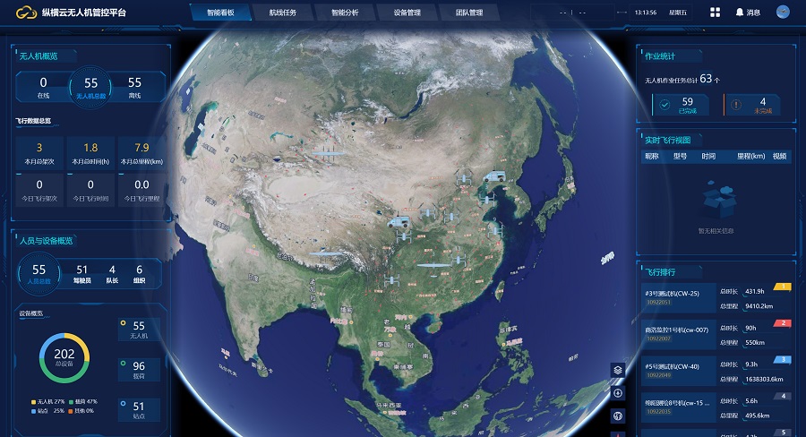
Cloud-Based Data Management and Analytics
With JOUAV's cloud-based platform, seamlessly manage and securely store your project data. Access your information anytime, anywhere, and effortlessly collaborate with your team. Leverage our advanced analytics tools to transform raw data into actionable insights, visualize project progress, and generate comprehensive reports. Monitor key performance indicators, identify trends, and make informed decisions with ease.
Seamless Software Integration and Data Visualization
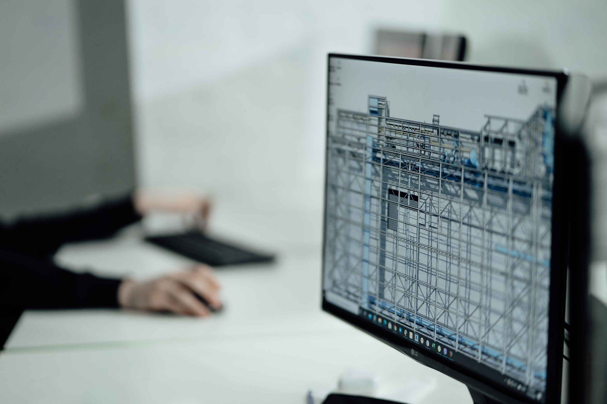
JOUAV's drones seamlessly integrate with leading construction software, effortlessly importing images, videos, and measurements. This streamlined workflow includes comprehensive 3D modeling, immersive virtual walkthroughs, and accurate site mapping, enhancing design and planning. Say goodbye to complex data transfers and manual processes, and experience improved visualization and decision-making in your construction projects.
Integration with Existing Workflows
JOUAV's drone services seamlessly integrate with your current workflows and software stack. Whether you utilize BIM, CAD, or other construction-specific software, our solutions effortlessly sync with your tools, ensuring a smooth and streamlined workflow. With our drone-captured images overlaid onto your models, you can visualize project data and gain a comprehensive understanding of your construction site like never before.
Comprehensive Training and Support
JOUAV provides comprehensive training and support to ensure a smooth integration of our drone services into your construction operations. Our expert team will guide you through implementation, offer hands-on training, and provide ongoing support to ensure you and your team are proficient in utilizing our advanced solutions.
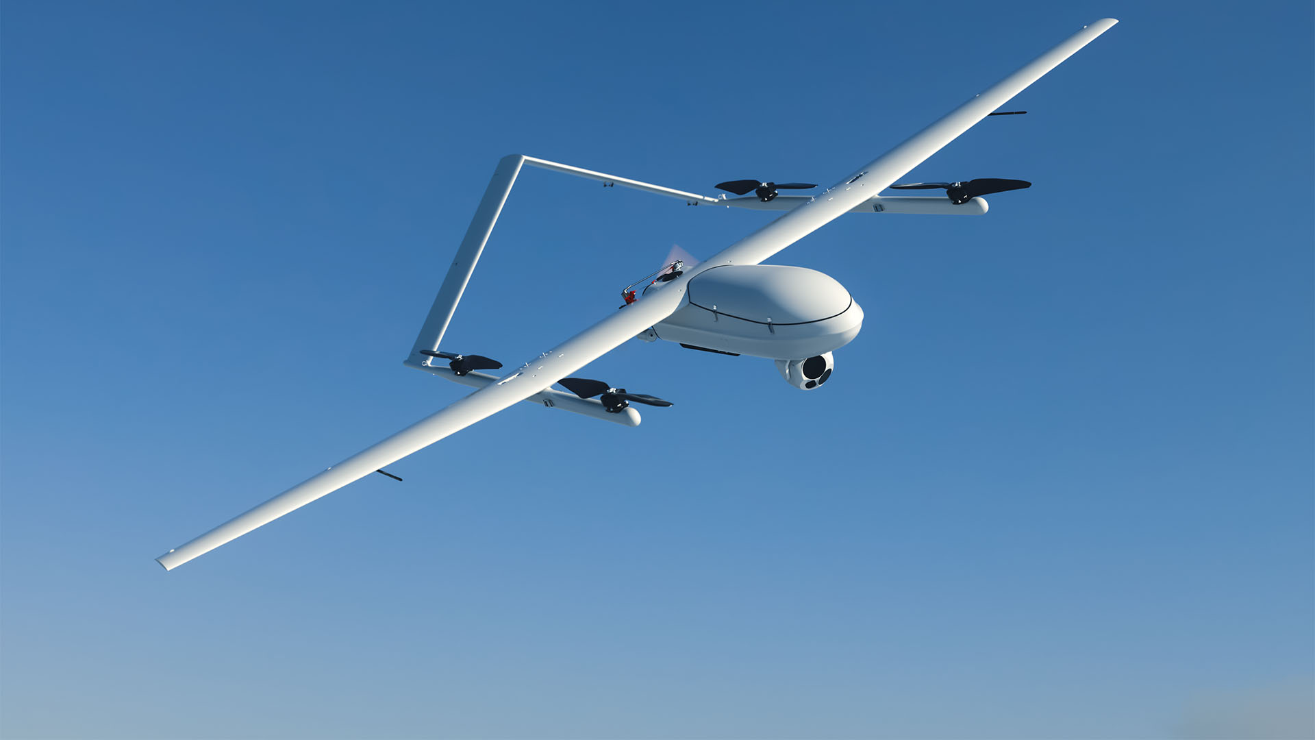
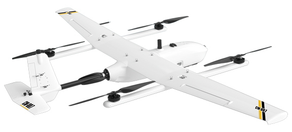
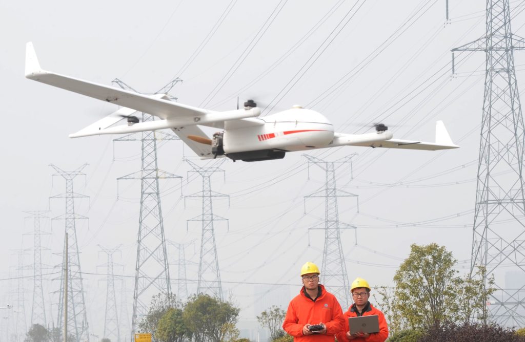
Verticle Take-Off and Landing (VTOL)
The take-off and landing features of CW Series drones make them perfect for the construction industry, especially in places with gravel, debris, and cliffs. Thanks to the large vertical static elevation during takeoff and landing, these UAVs have better attitude stability compared to other VTOL drones.
Multiple Payloads
With payload capacity between 7kg and 20kg, the CW Series heavy lift drones are capable of carrying different payloads, such as 61MP full-frame camera, 30x visible and thermal cameras, and 360º LiDAR sensors ranging up to 1845 meters, for most mapping and surveillance requirements.
Fast Speed and Large Coverage
With advanced engines and power management modules, the CW series drones can last up to 840 minutes and fly at speeds of up to 135km/h. In a single flight, the CW-007 drone can map 2 times more area than a traditional fixed-wing drone and 15 times more than a multi-rotor. As some of the best long range drones available, the CW Series UAVs are well suited for large-area mapping and surveillance, as it has control range options of 50 km, 100 km, and 200 km.
Accuracy and High-Resolution
The CW Series drones are all equipped with some kind of GPS correction technology in combination with RTK and PPK modules. These RTK drones compute centimeter-level GPS data and embed the data into each image. Using the 61MP full-frame CA-103 camera, the CW Series drones deliver best-in-class GSD down to 5-8mm per pixel and absolute horizontal accuracy down to 1cm under optimal conditions. When carrying JoLiDAR-LR22S, the CW Series LiDAR drones can achieve down to 2cm vertical accuracy without GCPs.
Autonomous Navigation and Control
The flight of the JOUAV drones is fully automated and requires a little training. Flight planning is done through the FlightSurv and Eagle Map, the former for mapping and the latter for drone surveillance. Both are very simple and intuitive applications that can support the management of multiple missions and data post-processing at the same time.
These aircraft have forward-looking and down-looking obstacle avoidance radar, which helps them scan the environment and detect any obstacle along their router time-time. With a four-rotor level-flying layout and mutually independent power systems, this series of UAVs can activate the rotor blades to make a safe forced landing after a level-flying power failure, reducing the incidence of bombing accidents.
Jocloud is the leading construction drone software, integrating drone data into a cloud-based platform. It enhances collaboration and coordination among construction teams with tools for route planning, data management, document control, issue tracking, and project analysis. It's essential for construction professionals using drones.


Types of Drones Used in Construction and Infrastructure
Different projects and different construction sites require different types of drones to get the job done properly. When it comes to drones, the first thing that comes to mind is quadcopter drones, which are the most common type on the market. However, there are other types of drones that are also being used in the construction industry. Let's have a look:
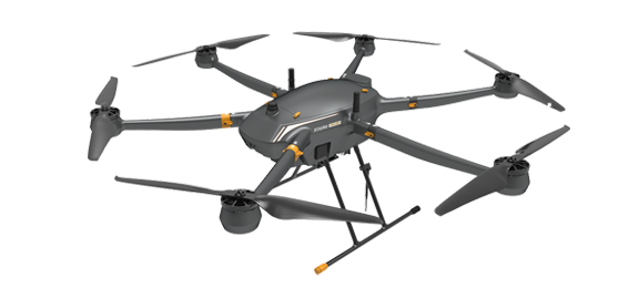
Multirotor Drones
Multi-rotor drones are most commonly used by professionals and hobbyists. They usually have 4-8 rotors and have a flight time of about 30 minutes.
Like helicopters, multi-rotors do not require a lot of space to take off and land and can hover in the air, making them ideal for tasks such as inspections and field surveillance. With their compact design, they are generally foldable and easy to store and transport. Multi-rotor drones are very easy to handle, and even inexperienced pilots can learn to fly in just a few minutes.
However, this type of drone has very limited flight time, speed, and load capacity, so they are not suitable for large-scale sites and projects with high accuracy requirements.
Fixed-Wing Drones
Fixed-wing drones look like airplanes, but they are much larger than multi-rotors. These drones are more stable than multi-rotor drones and can fly in harsh environments. Fixed-wing drones can usually float for hours in the air and fly faster than multi-rotors, enabling them to be commonly used to map large areas of land.
Fixed-wing UAVs are not as versatile as multi-rotor drones in the construction industry because they need a long runway to take off and land, which may not be convenient around construction sites. Except for that, fixed-wing drones are more difficult than multi-rotor drones and often require specialized flight training to fly them.
Helicopter Drones
Helicopter drones have one or two rotors with blades whose flight principle is the same as that of a manned helicopter, using rotating rotors to generate lift and thrust. With only a single rotor, helicopter drones use more energy efficiently, fly longer, and are more efficient to fly than multi-rotor drones.
The downside to using these drones is that they are difficult to fly because there is only one main rotor and the slightest imbalance can cause a collision with something in the environment.
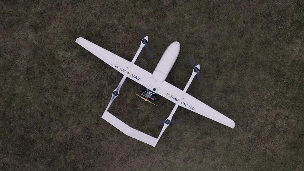
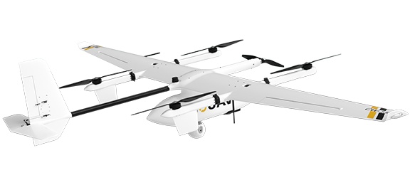
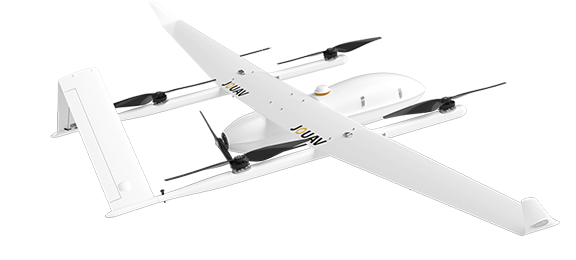
Hybrid Fixed-Wing
There are also hybrids of fixed-wing and multi-rotor drones on the market, which have the high efficiency and long endurance of fixed-wing drones but can also take off and land vertically like multi-rotor drones. But this VTOL drone model is expensive and hard to fly, requiring more flight training.
Drone Outputs of Construction Drones
Using the data collected during one flight of the construction drone, the post-processing software created the following different deliverables:
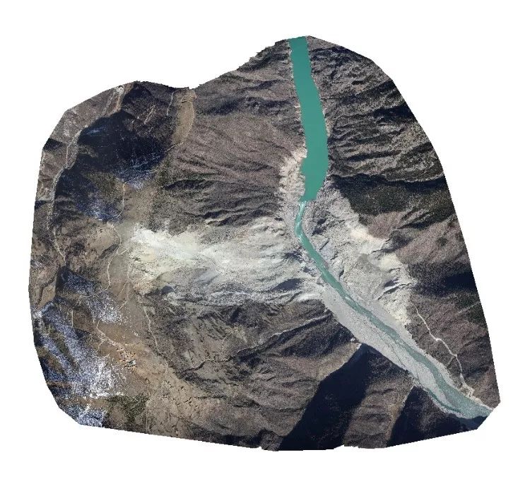
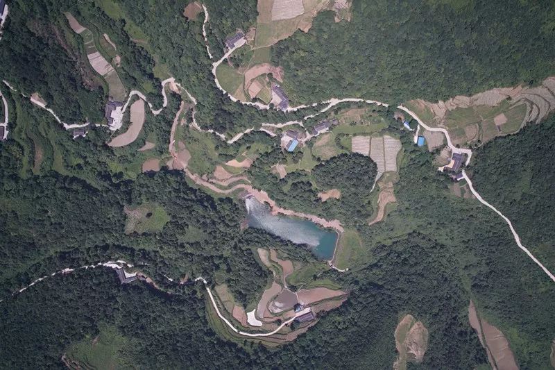
Orthomosaics
Drone photogrammetry takes several orthophotos during the flight and stitched them together in post-processing to create a highly accurate orthomosaic map. Each pixel of this map contains geographic information that helps crews measure the exact distance to the job site.
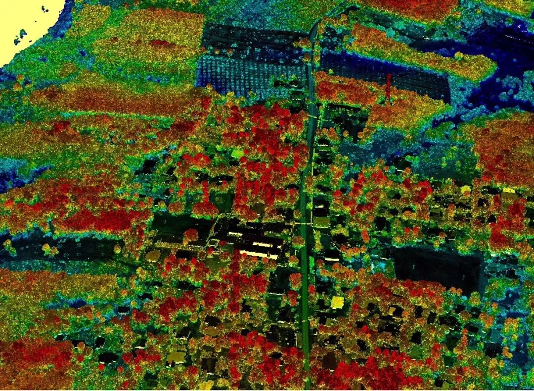
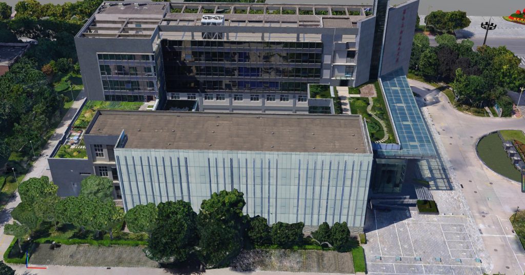
3D Textured Models
3D Texture models are a "mesh" of several triangular polygons that, along with the texture file, accurately reflect the topography of your job site. These models combine a bird's eye view of ground conditions with accurate positioning data, allowing construction and earthwork teams to examine and measure their sites and plan for the future.
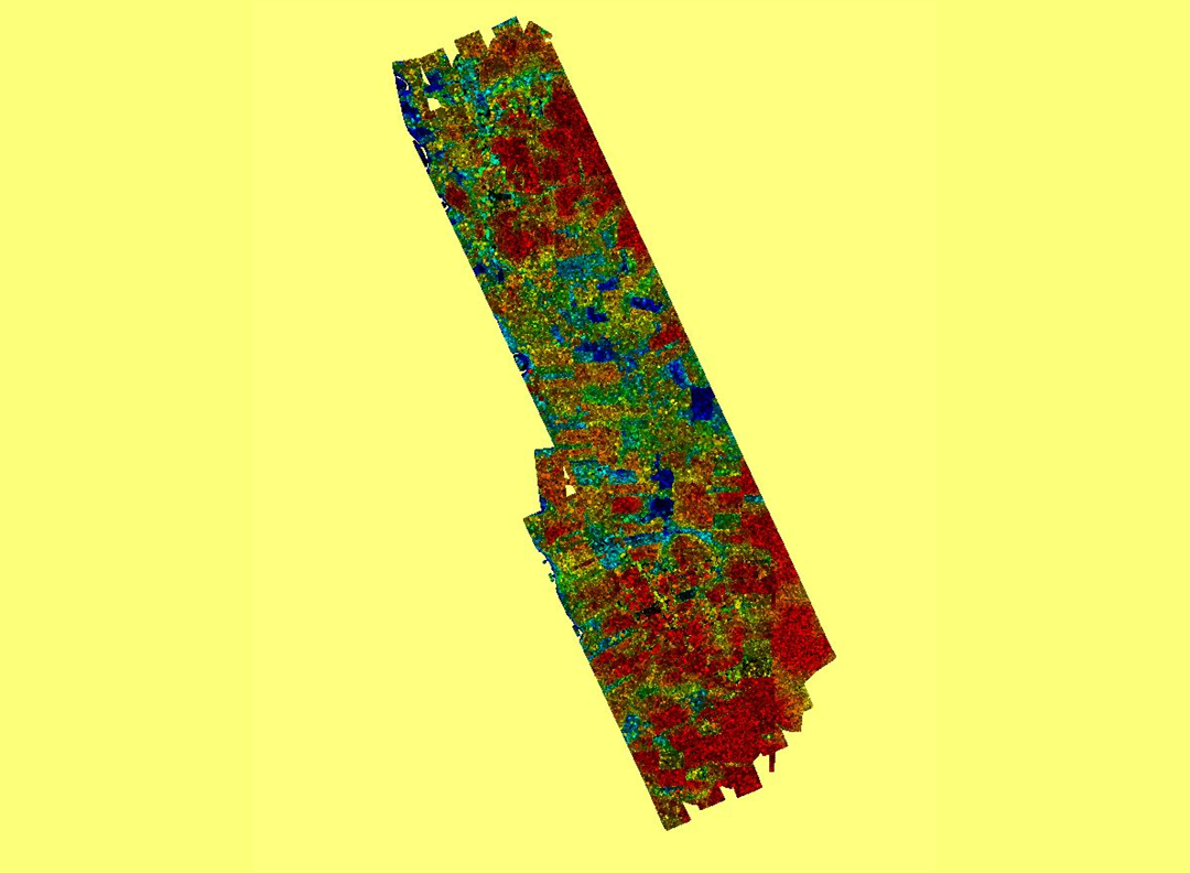
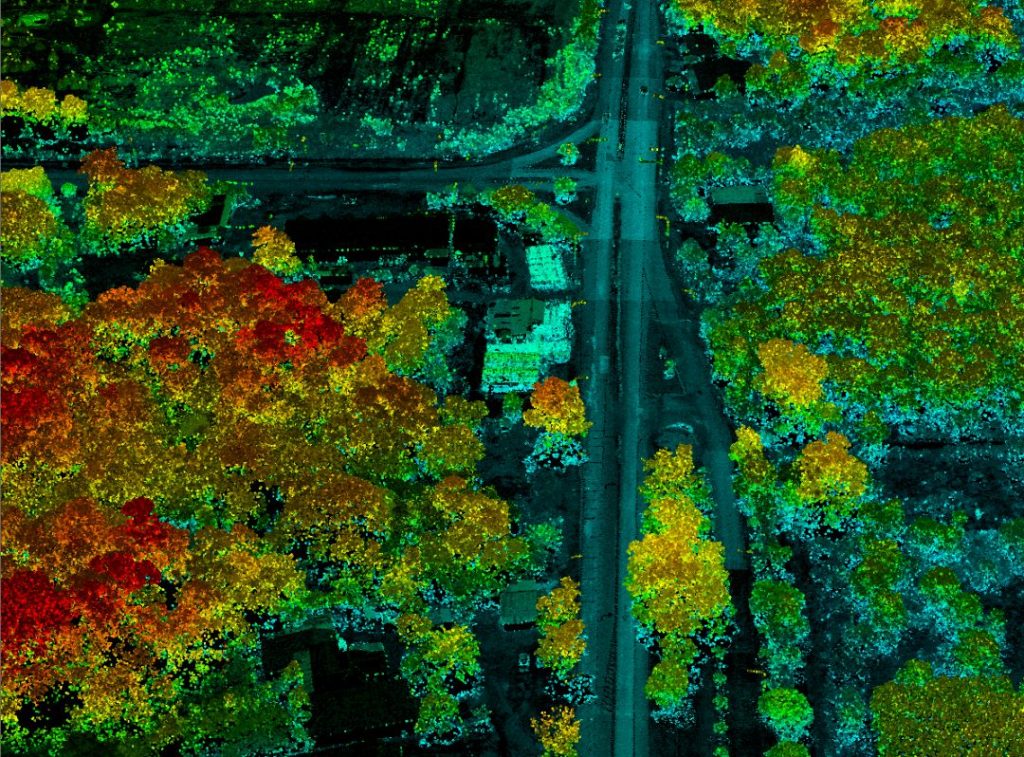
3D Point Clouds
3D point clouds can be generated from drone imagery. Each of its points references a distinct feature on your site, which is accompanied by geospatial coordinates and color information. In construction and civil engineering, point cloud modeling simplifies the measurement process for complex projects that include features such as roads, bridges, and buildings.
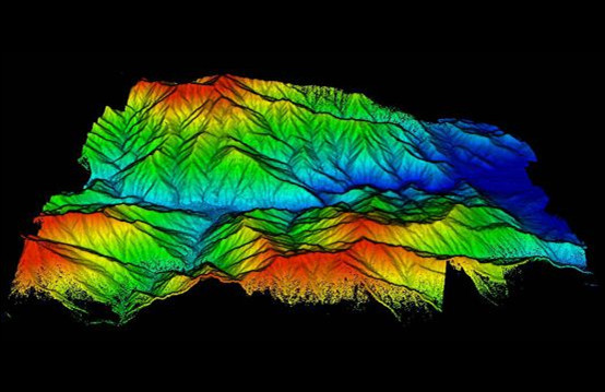
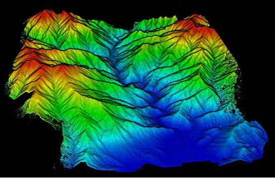
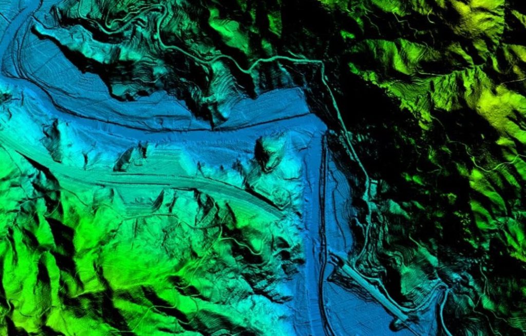
Digital Elevation Model (DEM)
Unlike textured models, digital elevation models (DEMs) show only the surface, with no texture data. Using raster datasets to represent the topography of a particular size and color to show differences in elevation, DEMs allow you to visualize the shape of the terrain at your site, aiding in drainage planning, line of sight coverage, foundation soundness, and more.
RAW Images
The raw image is the unprocessed original image taken by the drone, which provides more detail and is useful for equipment inspection and analysis.
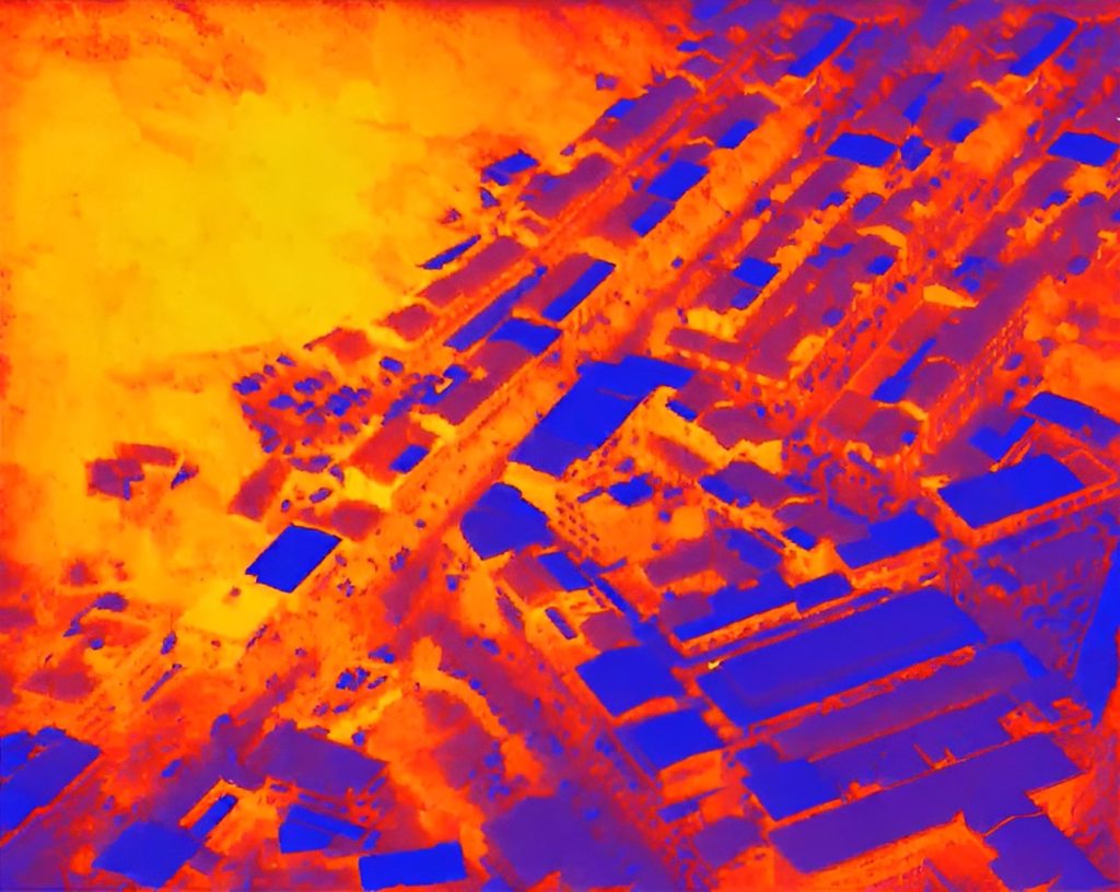
Thermal Imaging
Thermal imaging uses a spectrum of colors to represent different temperatures, the warmer color the higher temperature. By viewing these videos, operators can spot a range of building defects not visible to the naked eye, providing insight into thermal bridging, water leaks, and defective insulation.
Video Footages
Visible light and infrared videos record everything on the job site, from criminal activities to security issues. By reviewing these images, and annotating them, you visually share these project-building issues with your project team for immediate resolution.
Challenges of Drones in Construction and Infrastructure
Drones can be a very useful tool for any construction project, but there are still some downsides to using drones in construction, from user privacy and security to legal issues and unfair use.
Weather Dependent
Compared to conventional aircraft, UAVs are lighter and smaller, which makes them more dependent on favorable weather conditions. For example, in windy conditions, drones can be blown off course, preventing them from maneuvering properly or collecting reliable data or imagery. However, some high-end drones on the market are more stable and can successfully withstand gusts of wind.
Legislative Uncertainty
While the use of drones has become commonplace, drone laws continue to evolve and change, leaving people struggling to get the required permits and delaying the progress of their projects. Those construction sites in large urban areas need to be especially aware of changing regulations and permitting procedures, but for open space and rural areas, drone permitting is usually not a big issue.
If your construction site is located in a large city, you may have a hard time determining what permits you need to obtain. At this point, you need to look for a company like JOUAV that specializes in drones and can help your company navigate these regulations.
Vulnerable to Wild Animals
Drones are vulnerable to wildlife attacks and their noise can affect wildlife. When drones fly in areas where there is a significant amount of wildlife, they can clash with an animal or crash into a tree. Large birds of prey like hawks often attack or even capture drones operating in their space.
Knowledge and Skill
Capturing accurate, high-quality data with drones is based on the pilot's superior flying skills. And as discussed earlier, inexperienced pilots can easily cause drone accidents. That's why an average construction worker needs comprehensive training or a third-party construction drone service to capture, process, and analyze site data.
Easy to Hack
Drones, like most connected devices, are vulnerable to hacking. According to security researchers, hackers can quickly attack the central control systems of some commercial drones from a mile away to access private information, destroy or damage files, and leak data to unauthorized third parties.
Software Issues or Malfunction
Like any machine, drones can suffer from malfunctions and software failures. Drones' signals are often scrambled by radio frequencies, which can lead to loss of control. When drones veer off course, they can hit people and their sharp blades can cause injury and death. In addition to this, the mishandling of drones can cause safety accidents or hazards. Therefore, it is important to have not only reliable software and hardware but also trained professionals to fly them.
